How to drive the extreme 2,461m climb to Chorbat La?
Chorbat La is an international high mountain pass at an elevation of 5,141m (16,866ft) above sea level, situated on the border between India (Ladakh) and Pakistan (Gilgit-Baltistan). As one of the highest mountain passes of India, the route is a critical tactical corridor in the Himalayas. The 32.8 km unpaved track links the Leh and Ghangche districts, offering a brutal vertical challenge that tests the limits of vehicle cooling systems and driver physiology due to extreme altitude and terrain instability.
| Road facts: Chorbat La | |
|---|---|
| Location | India-Pakistan Border (Himalayas) |
| Elevation | 5,141 m (16,866 ft) |
| Length | 32.8 km (20.3 miles) |
| Elevation Gain | 2,461 m |
| Average Gradient | 7.50% |
What are the driving logistics of the 32.8 km climb to Chorbat La?
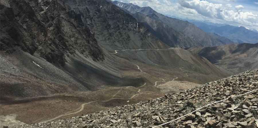
The ascent from Hanuthang to the summit of Chorbat La involves a massive 2,461-meter elevation gain. Logistically, this requires a vehicle in perfect mechanical condition, as the sustained 7.50% average gradient puts extreme pressure on the transmission for over 32 km. The road surface is a mix of gravel and loose rock, becoming "tippy" and bumpy in the higher sections. Maintaining a 4x4 configuration is a technical requirement to navigate the 30+ hairpin turns near the summit, where the terrain becomes increasingly unstable and the narrow track offers no room for error or mechanical recovery.
How does the 5,141m altitude affect vehicle performance on Chorbat La?
At an elevation of 5,141 meters, the atmospheric pressure is significantly reduced, leading to a power loss of nearly 50% in naturally aspirated engines. Logistically, the use of turbocharged diesel engines is the only viable technical solution for the Chorbat La climb. Drivers must monitor the engine’s thermal load constantly; the thin air reduces the radiator's cooling efficiency while the steep gradient increases the heat generated by the torque converter or clutch. It is mandatory to carry redundant cooling supplies and monitor for any signs of fuel starvation caused by vapor lock in the high-altitude, low-pressure environment.
What are the health and safety protocols for the Chorbat La pass?
Driving to 16,866ft is not only a mechanical challenge but a biological one. There are high chances of the crew being affected by Acute Mountain Sickness (AMS). Logistically, the rapid 2,461m ascent from Hanuthang does not allow for proper acclimatization. Technical safety protocols must include carrying portable medical oxygen and having a clear "descend immediately" plan if symptoms appear. Furthermore, the route is subject to strict military permit issues due to its location on the India-Pakistan border. Any transit must be coordinated with local authorities, as the road is often closed to tourists without warning due to operational security.
How to manage the terrain hazards of Chorbat La?
The final sector of Chorbat La is characterized by rocky and bumpy terrain with high vertical exposure. Logistically, the "tippy" nature of the track means that vehicle center-of-gravity management is crucial, especially when loaded with fuel and gear. The road is typically impassable from October to June due to heavy Himalayan snowfall. Even during the summer months, rockfalls are common near the towering cliffs of the pass. Drivers must maintain a slow, technical pace to avoid tire sidewall damage on sharp scree, as a puncture at 5,141m complicates the logistics of a wheel change due to the physical exertion required at this altitude.
Pic: neeraj kumar