A memorable road trip to Namika La in the Himalayas
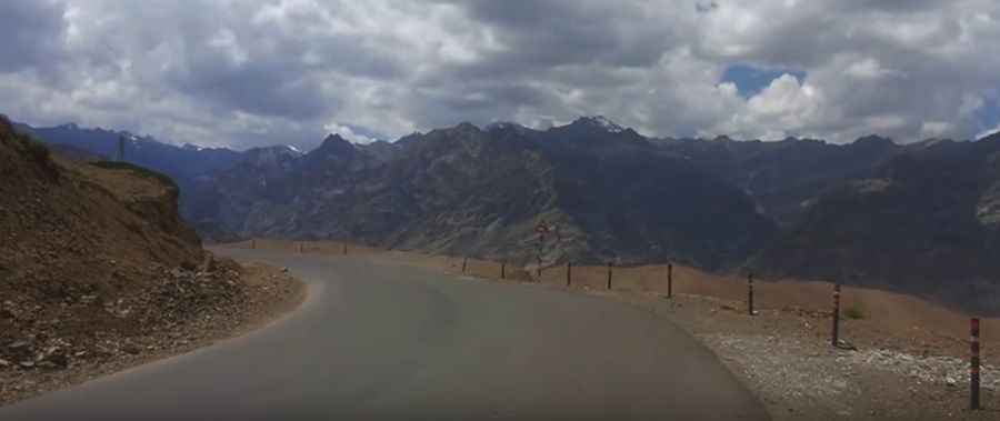
Namika La is a high mountain pass at an elevation of 3,823m (12,542ft) above sea level, located in Ladakh, India.
Where is Namika La?
Set high in the Zaskar Range of the Himalayas, the pass, also known as Namika Pass and Pillar of the Sky Pass, connects the Leh and Kargil regions. It is one of two high mountain passes between both regions, with the other being the even higher Fotu La Pass.
How to get to Namika La?
The road to the summit is fully paved, called National Highway 1 (NH 1) or the Srinagar Leh Highway. The drive is quite challenging with hairpin turns and sharp curves. Driving at night or in poor visibility is not recommended for drivers unfamiliar with the road. Along the way, there are frequent memorials at previous accident sites. Always give way to trucks.
How long is Namika La?
The road is 24.1 km (14.97 miles) long, running west-east from Mulbekh to Khangral.
Is Namika La open in winters?
It is usually impassable from October to June (weather permitting) due to snow. High winds blow here all year long. The climate is so harsh that the area is barren, with no greenery or life. The pass is located on a completely deserted weathered ridge, resembling a lunar landscape. Once you cross the pass, you can admire the breathtaking view of the lush green surroundings and snow-covered peaks. It is a must-visit place in Ladakh and also the last pass before entering the Kargil region.
Road suggested by: Hugh Wilson
Pic&video: travel log