Road Trip Guide: Conquering Depsang La
Depsang La is a high mountain pass at an elevation of 5,376 m (17,637 ft) above sea level, located in the Leh district of Jammu and Kashmir, India. It’s one of the highest roads in the country.
Where is Depsang La?
The pass is located south of Karakoram La, close to the Chinese-controlled Aksai Chin, near the Line of Actual Control, which divides the territories administered by India and China.
Is the Road to Depsang La Unpaved?
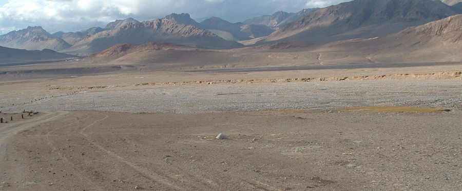
The road to the peak is totally unpaved and consists of gravel and rocks, often uneven and rough. The pass presents dangers and poses difficulties for summit expeditions due to its elevated position, altitude-related health risks, unpredictable weather conditions, steep gradients, and overall remote location.
How Long is the Road to Depsang La?
The road to the summit is 35.7 km (22.18 miles) long, starting from Murgo, also known as Murgo Nala, a small hilly village. A 4x4 vehicle is mandatory, as the narrow road is severely damaged due to frequent use by military convoys.
Is the Road to Depsang La Open in Winter?
Set high in the Karakoram mountain range, the road becomes impassable during winter due to snow. Snowslides, intense snowfall, and landslides are potential hazards, particularly risky due to icy patches. Renowned for its perilous nature, the pass is notorious for unpredictable snowstorms and blizzards, making driving exceptionally difficult. With its elevated summit, the pass is susceptible to heavy winter snowfall, leading to closures when the road is obstructed by snow.
How Challenging is Driving to Depsang La?
Avoid undertaking this journey if you suffer from respiratory issues or any cardiac ailments. The infamously low oxygen levels strain the body, and coupled with the steep incline, altitude sickness typically afflicts individuals at altitudes between 2,500 to 2,800 meters. Engine combustion faces significant challenges due to the scarcity of oxygen at such high elevations.
Pic: http://himalayancamping.com/MainPic02/kkp_trek20m.jpg