The road to Sinthan Top is not for you if you’re prone to car sickness
Sinthan Top is a high mountain pass at an elevation of 3.792m (12,440ft) above sea level, located in Anantnag district in the Indian state of Jammu and Kashmir.
Is the road to Sinthan Top paved?
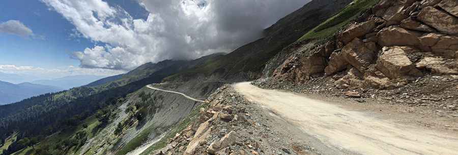
The curvy road to the summit is mostly paved. It’s called National Highway 244 (NH 244). It was resurfaced in 2018 and provides a secure ascent. However, it has a high risk of rock slides.
How long is the road to Sinthan Top?
The defiant road through the summit is 150 km (93.20 miles) long, running north-south from Anantnag to Kishtwar. Expect thousands of twists, some steep parts and narrow sections. Historically, local shepherds and traders used this pass to transport goods and cattle.
Is Sinthan Top open?
Set high in the Pir Panjal mountain range, Sinthan Top is often affected by bad weather. Even in June, you might see patches of snow that frequently blocks the route. Heavy snowfall makes the area inaccessible for most of the year, and it is only open during the summer months.
When is the best time to drive to Sinthan Top?
The weather can be unpredictable, so be prepared for sudden changes and carry appropriate rain or snow gear. The best time to visit is between April and September.
Is Sinthan Top worth a visit?
The drive to Sinthan Top, with its many bends, is very scenic and each turn provides excellent photo opportunities, so bring your camera. Recently, it has become a popular tourist destination in Kashmir. The summit offers a stunning 360-degree view.
Road suggested by: Hugh Wilson
Pic: Shaanz