Adventure along the wild road to Wari La Pass
Wari La is a high mountain pass at an elevation of 5.312m (17,427ft) above sea level, located in northern India’s Jammu and Kashmir state. It’s one of the highest roads of the country.
Can you drive to Wari La?
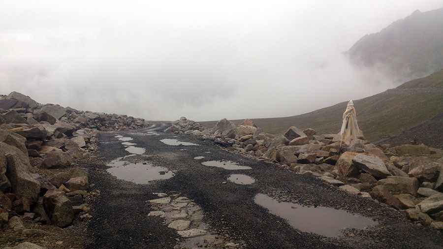
Set high in the Nubra valley, to the north east of Ladakh valley, the road to the summit is extreme, with countless curves and sharp hairpin turns. It’s very steep and the surface is paved in parts, but really bad. Expect a bit of broken tarmac in a few places. Remember to take a medicine if you are prone to motion sickness. Be prepared: it is quite remote and there are times when you may not see anyone. Along the way you’ll need to face a few water crossings, mainly due to melting snow. These crossing can be challenging, menacing, or just a puddle depending on the time of the day and time of the season you happened to be there.
Is the road to Wari La open?
This road is usually impassable from late October through late June or early July (depending on snow). The open and close dates all depend on snowmelt and snowfall each year. Be aware of stray dogs. While following the trail, you may not get any signal on your phone.
How long is the road to Wari La?
The pass is 62.3 km (38.71 miles) long, running south-north from Sakti to Agham. Starting from Agham there are plenty of steep sections and you will be grinding up in your lowest gear for quite a few hours. The zigzags on the south side of the pass lose height tortuously slowly. There are no signboards here. Well there was one, but now it’s no longer there. Only prayer flags mark the pass.
What’s the best vehicle to drive through Wari La?
When embarking on journeys along high mountain roads characterized by low oxygen levels, individuals must be aware of the potential health implications they may face and the consequential impact on vehicle performance, which consequently establishes biking as the most favored and recommended mode of transportation for traversing challenging routes such as Wari La; however, it is worth noting that 4x4 SUVs can also be utilized as an alternative option, albeit with a significantly limited number of tourist vehicles opting for this road due to its demanding nature.
Pic: Dhruvaraj Subhashchandran