Here's How To Have The Ultimate Road Trip To Photi La
Photi La is a high mountain pass at an elevation of 5,532m (18,149ft) above sea level, located in southeastern Ladakh in the eastern Jammu and Kashmir state of India. It’s one of the highest roads in the country.
How long is Photi La?
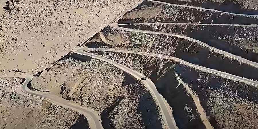
The road to the summit is mostly paved. It’s called Photi La road. Starting at Hanle, a large historic village, the road is 16km (9.94 miles) long. The road offers amazing scenery, and the Hanle valley can be seen from it. The approach is very steep, with almost no road and no soul around and very little oxygen. If you cross the pass and continue further, you will reach Umling La.
Is the road to Photi La defiant?
Tucked away in the Changthang region, the drive features countless turns and hundreds of hairpin turns. The road is very steep, hitting a 15% maximum gradient through some of the ramps. Starting at Hanle, the elevation gain is 1,274 meters. The average gradient is 7.96%. Part of the ancient Ladakh–Tibet trade route, a 4x4 vehicle is required.
Is the road to Photi La open?
The road to the summit is impassable in winters. Before you get anywhere near the pass, you will see signposts indicating that the ILP permit zone ends, and you are not allowed to keep going. If you keep going, you may be arrested and prosecuted by the Indian army.
Road suggested by: Hugh Wilson
Pic&Video: XTREME MOTO ADVENTURE