Spiti Valley Road is one of the toughest roads left on Earth
Spiti Valley Road is located in a desert mountain valley, high in the Himalaya mountains, in the north-eastern part of the Indian state of Himachal Pradesh. Carved into the mountains, it’s said to be one of India's most dangerous roads.
Is the road to Spiti valley unpaved?
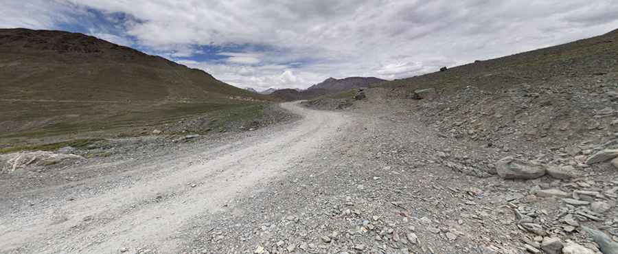
Set high in the western Himalayas, the road, also known as Gramphu-Batal-Kaza road, has gravel and paved sections. 80% of the route has no pavement. The condition of the road deteriorates quickly on entering Lahaul. Soil is loose and keeps shifting, ensuring that freshly laid tarmac doesn’t even last for a year.
Is the road to Spiti valley safe?
Along the road, you will have to forge streams, perhaps even small rivers, negotiate melting glaciers, and drive over piles of sand, rocks, and snow. It’s a narrow road barely good enough to drive that reminds that they are still connected with the world and also gives them access to the terrain that almost feels uncharted. Driving involves wading through streams originating from melting snow, which run across the road in a bid to meet Chandra River far below in the valley. Sections of the road are narrow enough to barely let a jeep pass, and any error in judgment would only mean tumbling down the valley and into the fast-flowing river. Yet, there are hardly any accidents, thanks to little traffic and the drivers who are used to these roads.
How long is Spiti Valley Road?
The road is 137 km (85 miles) long and runs from Kaza to Gramphoo, at the foot of Rohtang Pass, in the Lahaul and Spiti district of the northern Indian state of Himachal Pradesh.
Do I need a 4x4 vehicle to drive the Spiti Valley Road?
Any SUV will probably be the best car: it doesn't matter if it is a 2-wheel drive or 4×4, but the good ground clearance an SUV offers will be of great help while traveling through Spiti. This painfully slow driving runs along some of the most treacherous terrains in the world, and sign boards along the way exhort drivers to be careful.
Is Spiti Valley Road open?
The road tops out at the dramatic Kunzum Pass, at an elevation of 4,556 m (14,947 ft) above sea level. It is one of India’s highest motorable mountain passes. The road switchbacks precipitously up to this pass and runs up the dramatic, glacier-carved Chandra Valley. Most of the road is above 11,000 feet above sea level and only accessible between May and October.
Is the Spiti Valley Road remote?
The drive is extremely remote in parts. There are no houses, no people, no vehicles to give way to, or anything to remind of the world you left behind.
Pic: ankush kumar