Razdan Pass is an adrenaline-pumping road in India
Razdan Pass is a high mountain pass at an elevation of 3,543m (11,624ft) above sea level, located in Jammu and Kashmir, India. It’s one of the scariest roads in the world.
Where is Razdan top located?
The pass is located in the Gurez Valley, in north Kashmir’s Bandipora district of Jammu and Kashmir. The pass connects dozens of remote and far-flung areas, including those near the Line of Control (LoC) with the district headquarters Bandipora in north Kashmir.
Can you drive to Razdan Pass?
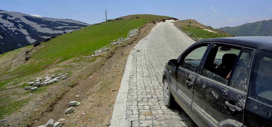
The road to the summit, also known as Tragbal Pass, Razdan Top, and Rajdhan Pass, is mostly paved, with concrete sections on the steepest gradients. It’s called Gurez-Bandipora Road.
How long is the road to Razdan Pass?
The pass is 58.8 km (36.53 miles) long, running from Kazalwan to Manrigam. It’s a scary drive, with dangerous drop-offs, fast icy winds, and repeated snow accumulation. The drive is pretty daunting, with hundreds of turns unprotected by guardrails.
Is the road to Razdan Pass busy?
Once an integral part of the Silk route between Kashmir and Central Asia, today the road is lightly used, connecting Gurez with the rest of the state. There are plans to build a new 18km long tunnel to bypass the most challenging part of the road. Not many people know the pass, and hardly any tourists go this way.
Is Razdan Pass open?
Set high in the Himalayas, the pass remains closed for 6 months in a year because of the huge amount of snowfall.
How long does it take to drive the road through Razdan Pass?
To drive the road without stopping will take most people between 2.5 and 3 hours. The road offers breathtaking views of the area.
Pic: Gurez Hut