Driving the Scenic Paved Mountain Road to Namshang La
Namshang La is a high mountain pass at an elevation of 4,960m (16,273ft) above sea level, located in the Ladakh region of the northern Indian state of Jammu and Kashmir.
Where is Namshang La?
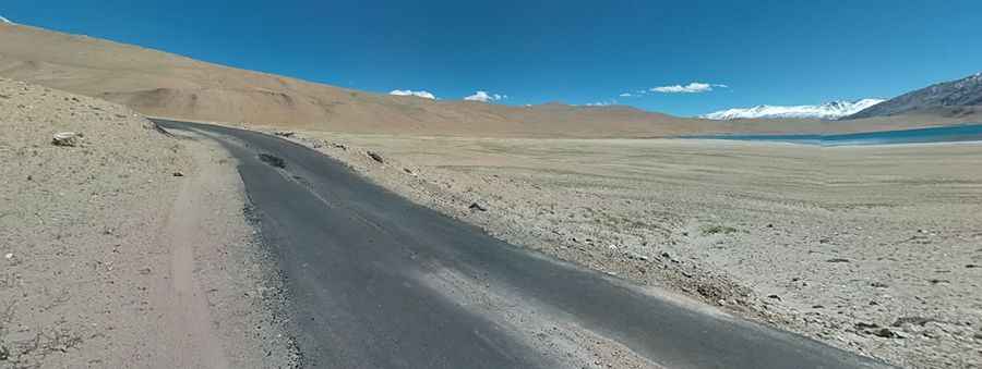
The summit is crowned with hundreds of Buddhistic prayer flags. Situated near the scenic Tso Moriri Lake, in the northern part of the country, the pass connects Indus-Valley in the North with the high plateau of Tsomoriri, a huge lake at an altitude of 4,500m close to the border with Tibet.
Is the road to Namshang La paved?
The road through the pass is a smooth black tarmac that was recently paved. The area is very remote and very sparsely populated, but is full of amazing beauty. There are essentially no villages en route to provide shelter, and there are no petrol pumps in the area. Therefore, carrying enough fuel is necessary.
How long is the road through Namshang La?
Located in the Rupshu region, the road is 44.8 km (27.83 miles) long, running north-south from Sumdo to Korzok, one of the highest towns in India.
Is the road to Namshang La open in winter?
Set high in the Changthang Plateau, the area experiences freezing temperatures during the winter months. Accessibility is largely limited to the summer season. It’s a high mountain road, and be aware that you'll cross several very high passes and experience very cold nights even in mid-summer. The road climbs up to Kiagar La, a high mountain pass at an elevation of 4,859 meters (15,941 feet) above sea level, and Kyagar Tso, a very small saline lake at an elevation of 4,705 meters (15,436 feet) above sea level.
Pic: Michael L