Driving the challenging road to Se La Pass in the Himalayas
Se La (Sela Pass) is a high mountain pass at an elevation of 4,198 meters (13,772 ft) above sea level on the border between Tawang and West Kameng districts in Arunachal Pradesh, India. Located in the Eastern Himalayas, the pass on National Highway 13 (NH13) connects Dirang with Jang and Tawang.
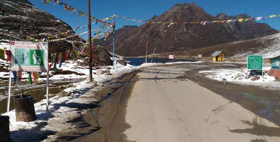
| Road facts: Se La Pass | |
|---|---|
| Location | Tawang / West Kameng, Arunachal Pradesh (India) |
| Elevation | 4,198 m (13,772 ft) |
| Length | 100 km (62.1 miles) between Dirang and Jang |
| Road Designation | National Highway 13 (NH13 / Trans-Arunachal Highway) |
| Surface | Paved asphalt with unpaved gravel sectors |
| Bypass Infrastructure | Sela Tunnel (Bypasses the 4,198m crest) |
Where is Se La Pass located?
The pass is situated in the western part of Arunachal Pradesh, traversing the Eastern Himalayas along National Highway 13 (NH13). The route serves as the primary overland connection between Tezpur/Guwahati and the Tawang valley near the border with Tibet.
Is the road to Se La Pass paved?
Yes, National Highway 13 over Sela Pass is primarily paved with asphalt. However, frequent freeze-thaw cycles, monsoon rain, and heavy military truck traffic break up the surface, leaving several high-altitude sectors as rough gravel and mud tracks.
How long is the drive over Se La Pass?
The mountain section spans 100 kilometers (62.1 miles) between Dirang and Jang. Navigating the continuous switchbacks and high-altitude climbs takes between 3 and 4 hours of driving time in clear weather conditions.
Does the Sela Tunnel bypass the pass?
Yes. The Sela Tunnel, constructed by the Border Roads Organisation (BRO) at an elevation of 3,000 meters, bypasses the highest 4,198-meter pass. The twin-tunnel system ensures all-weather connectivity on NH13 when heavy snowpack blocks the surface road over the ridge.
Pic: Indranil Kundu