How to drive the high-altitude track to Marsimik La?
Marsimik La is one of the ultimate challenges for any 4x4 driver, sitting at a staggering elevation of 5,590m (18,339ft) above sea level. Located in the Ladakh region of India, just 4 km from the Line of Actual Control with China, this is one of the highest mountain passes in India and a true test of mechanical endurance.
| Road facts: Marsimik La | |
|---|---|
| Location | Ladakh, Jammu and Kashmir (India) |
| Elevation | 5,590 m (18,339 ft) |
| Length from Phobrang | 79.7 km (49.5 miles) |
| Max Gradient | Over 10% in final sections |
| Permit | Indian Citizens Only (Inner Line Permit) |
Where is Marsimik La?
The pass is tucked away in the Chang-Chemno Range, acting as a high-altitude gateway near the border with China. Logistically, reaching Marsimik La is a massive undertaking that starts from Phobrang. It’s important to note that while the pass is open to Indian citizens with a permit, it remains off-limits for foreigners due to its proximity to the sensitive military zone. The road is often used by army convoys, and you are driving through a barren, high-desert landscape where help is hours, if not days, away.
Is the road to Marsimik La unpaved?
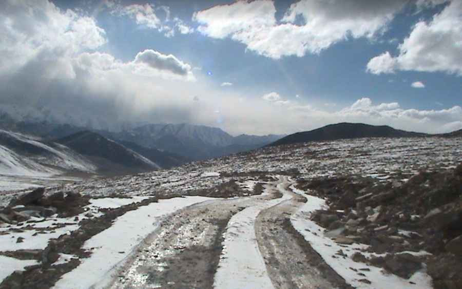
Most of the 79.7 km journey is unpaved and incredibly rough. What starts as a dusty track quickly turns into a nightmare of sharp rubble and massive rocks. This isn't just a "dirt road"; it’s a surface that will try to destroy your undercarriage at every turn. You need to be extremely careful with your line choice to avoid slashing a sidewall on the jagged stones. As you climb higher, the loose soil makes traction a constant struggle, especially on the steep hairpins nearing the summit.
Do I need a 4x4 for Marsimik La?
Absolutely. Attempting this without a low-range 4x4 and a very experienced driver is a recipe for disaster. The real killer here is the altitude. At 5,590 meters, the air is so thin that your engine will gasp for breath, losing a huge percentage of its power. If your vehicle isn't in top mechanical shape, it simply won't have the torque to crawl over the large boulders on the final, steepest ramps. It’s a slow, grueling grind where you have to monitor your temperature gauges constantly to avoid overheating in the rarified air.
How long does it take to drive Marsimik La?
Expect the 79.7 km drive to take at least 3 to 4 hours of pure driving time, but you should plan for a full day. The 1,166-meter elevation gain from Phobrang is relentless. Between the proximity to Kiu La and the hostile environment, you need to make sure you start early enough to get back down in daylight. The descent is just as punishing on your brakes as the climb is on your engine, and doing it in the dark on a cliff edge with no barriers is something no driver should ever attempt.
Is Marsimik La open?
Due to the extreme altitude, the pass is impassable for most of the year. Deep snow and ice block the track from late autumn until well into the summer. Even when it’s "open," the weather can shift in minutes, turning the dust into a muddy trap or covering the rocks in a layer of ice. There is a small temple at the summit, but the real reward is just making it to the top without breaking an axle or getting bogged down in the loose, high-altitude scree.
Pic: Neeti Bassi