Girthi Dobala: Driving the steep Girthi Valley canyon road in Uttarakhand
Girthi Dobala (Girthi Valley Road) is a high-altitude mountain road reaching an elevation of 3,332 meters (10,931 ft) above sea level in the Chamoli district of Uttarakhand, India. Carved into the sheer rock walls of the Girthi Ganga river gorge—often referred to as the Grand Canyon of India—the narrow track was constructed by the Border Roads Organisation (BRO) for military access toward the Line of Actual Control (LAC).
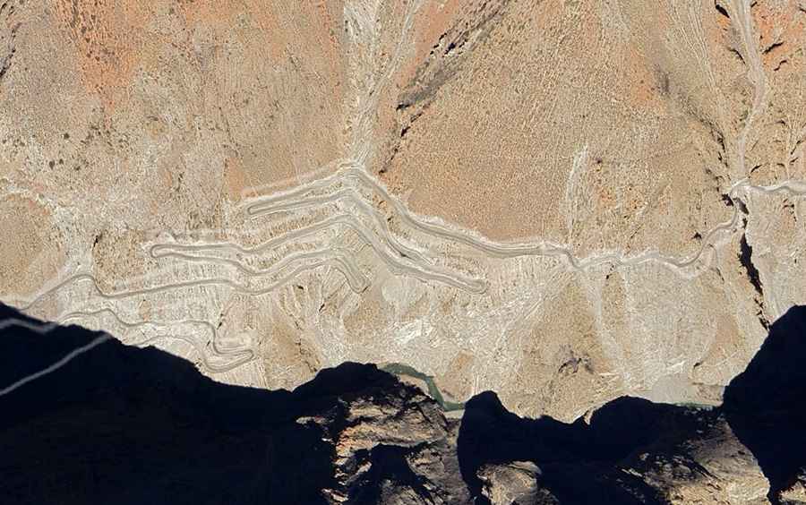
| Road facts: Girthi Dobala (Girthi Valley Road) | |
|---|---|
| Location | Chamoli District, Uttarakhand (India) |
| Coordinates | 30°42'22.4"N 79°56'51.8"E |
| Elevation | 3,332 m (10,931 ft) |
| Route Section | Sumna Road (Malari to Sumna corridor) |
| Surface | Unpaved loose gravel, broken rock, and shale earth |
| Access Restriction | Restricted military zone (Inner Line Permit / Closed to foreign tourists) |
| Key Hazards | Unshielded canyon drop-offs, severe rockfalls, extreme single-lane bottlenecks |
Where is Girthi Dobala located?
The road is situated in the Garhwal Himalayas of northern Uttarakhand, running northeast from Malari along the narrow Girthi River valley toward the military outpost at Sumna. The coordinates for the Girthi Dobala pass sector are 30°42'22.4"N 79°56'51.8"E.
Is the Girthi Valley Road paved?
No. The route is entirely unpaved, consisting of crushed rock, loose river gravel, and uncompacted earth. Built along steep cliff faces, the single-lane road features continuous blind hairpins, steep incline ramps, and unshielded drops into the riverbed without protective guardrails.
Can civilians or foreigners drive to Girthi Dobala?
No. The entire corridor beyond Malari operates under strict Indian Armed Forces jurisdiction due to its proximity to the Tibet/China border. Civilian access requires an Inner Line Permit (ILP), and foreign nationals are strictly prohibited from entering the area.
What hazards exist on the Girthi Dobala road?
The main physical hazards are active rockfalls triggered by monsoon rains, unstable overhangs along the gorge walls, and narrow track widths where vehicles cannot pass each other. Winter brings severe snowpack and freezing temperatures, closing the unpaved corridor from late autumn until spring clearance operations begin.
Road suggested by: Hugh Wilson