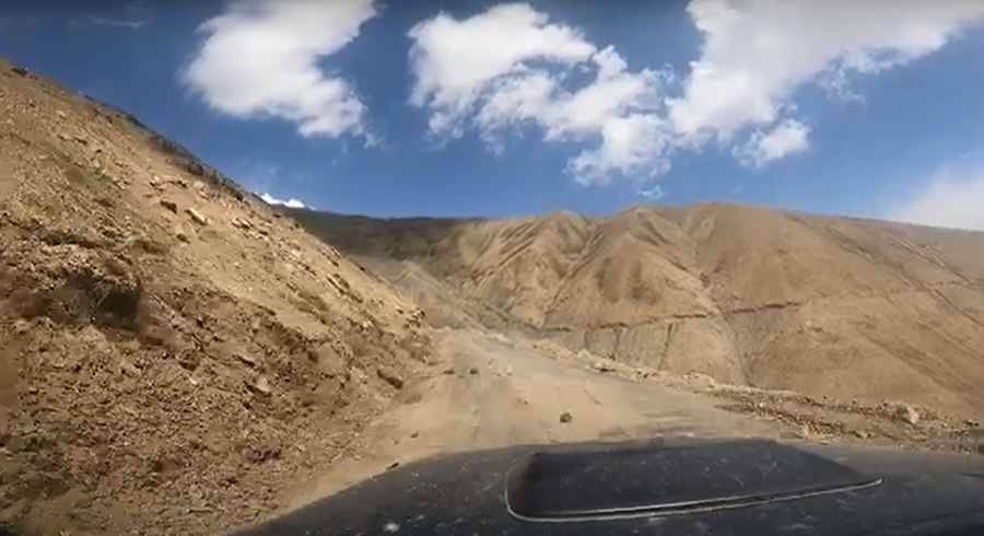
Driving the remote road to Manman Top is an otherworldly experience
Manman Top is a high mountain pass, standing at an elevation of 4,302m (14,114ft) above sea level, situated in the Indian state of Jammu and Kashmir. The journey to the summit offers a complete off-roading adventure.
Where is Manman Top?
The pass is nestled within the Suru Valley, close to the Line of Control (LoC), delineating the Indian- and Pakistani-controlled territories of the former princely state of Jammu and Kashmir.
When was the road through Manman Top built?
Several years ago, the route across Manman Top served as a trekking trail for both local shepherds and adventure enthusiasts. Commencing from Dras, the trek would traverse Manman Top and Umba La passes before reaching Sankoo. However, following the Kargil War events in 1999, which resulted in shelling along sections of the main highway, a road was constructed through the pass. This road, designed as a shortcut between the two towns, significantly reduced the distance to approximately 65 kilometers and considerably shortened the travel duration.
How long is the road through Manman Top?
The road to the summit spans about 60km (37 miles), stretching from Dras to Sankoo. It is mostly unpaved, featuring not one but two passes along the route. The first is Manman Top, when approaching from Dras, followed by Umba La. Due to its elevation, the road is typically open for approximately five months annually, from June to October. It traverses narrow sections with perilous drop-offs, numerous twists and turns, and steep inclines.
Is the road through Manman Top remote?
The road winds through uninhabited regions, lacking rest stops or other amenities compared to the original road. Presently, the route is primarily frequented by biking and trekking groups, with minimal general traffic usage.
Road suggested by: jorge manuel gómez sánchez