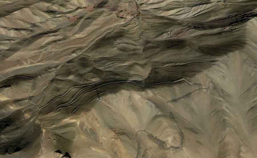
Driving the steep road to Shakhar La
Shakhar La is a high mountain pass at an elevation of 3,602m (11,817ft) above sea level, located in the Ladakh region of northern India. The pass is situated in the Aryan Valley, north of Chiktan. It is one of the many high-altitude tracks in the Himalayas that connect small, isolated mountain settlements.
| Road facts: Shakhar La | |
|---|---|
| Location | Ladakh, India |
| Length | 9.8 km (6.08 miles) |
| Elevation | 3,602 m |
| Surface | Unpaved (Dirt / Gravel) |
| Hazard Level | High (Hairpin turns & Rock slides) |
Is the road to Shakhar La paved?
The road to the summit is entirely unpaved. It is a very challenging drive that consists of a narrow dirt and gravel track. Because of the steep sections and the loose surface, a 4x4 vehicle is required. The road is known for having hundreds of hairpin bends and very narrow stretches with dangerous drops and no guardrails, so it requires a lot of concentration from the driver.
How long is the road to Shakhar La?
The road through the pass is 9.8 km (6.08 miles) long, running in a south-north direction from the village of Hagnis to Shakar. Despite being a relatively short distance, the drive takes a long time because of the constant turns and the technical nature of the climb. It is a slow and steady ascent through a rugged mountain landscape.
When is the road to Shakhar La open?
Accessibility to Shakhar La depends entirely on the weather. The road can be closed at any time during the winter months due to heavy snow and dangerous ice. Even in the warmer months, rock slides are a common risk in this part of Ladakh. If you plan to drive this route, it is important to check the local conditions and avoid the pass during or after heavy rains or snowfalls.
Road suggested by: Hugh Wilson