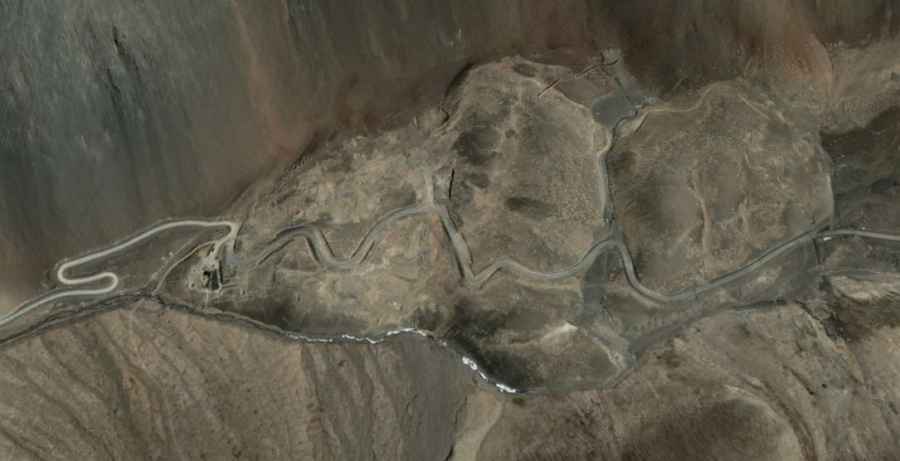
Driving to Jianan Pass: A 5,360m military route in the Kugrang Valley
Located in the remote Ladakh region, on the high-altitude boundary of the Himalayas, Jianan Pass (also known as Jianan Daban) is one of the most isolated and sensitive mountain crossings in the world. Reaching a staggering elevation of 5,360m (17,585ft) above sea level, this is not a civilian road but a raw, unpaved military track known as the Kugrang Valley Road. It is a journey through a high-consequence environment where geography and geopolitics collide at oxygen-deprived altitudes.
| Road facts: Jianan Pass (Jianan Daban) | |
|---|---|
| Location | Ladakh, India (Kugrang Valley) |
| Elevation | 5,360 m (17,585 ft) |
| Length | 123.9 km (from Phobrang) |
| Surface | Totally Unpaved (Dirt and Scree) |
| Status | Restricted Military Access |
Why is the 123km drive to Jianan Pass so dangerous?
The transit to Jianan Pass starts at Phobrang and covers 123.9 km of the most desolate terrain in the Himalayas. The road is a pure "dirt and scree" track, carved by military engineers to maintain supply lines in the Kugrang Valley. At an elevation of over 5,300 meters, engines lose nearly 50% of their power due to the lack of oxygen, and the risk of acute mountain sickness for the driver is a constant threat. The track is notorious for its deep ruts and the river crossings that can swell instantly with glacial meltwater, turning a 123 km journey into a multi-day survival operation for any 4x4 rig.
What are the hazards of the Kugrang Valley Road?
Beyond the technical difficulty of the terrain, the Jianan Daban is a zone of extreme geopolitical tension. As a primary site of the China-India standoff since 2020, the road is heavily monitored and often blocked by military checkpoints. The environment is "zero-infrastructure"; there is no electricity, no medical aid, and zero cell service for over 100 kilometers. The weather at the summit can drop well below -30°C, and sudden blizzards can bury the track in minutes, leaving vehicles stranded in one of the highest mountain passes of India. In this high-altitude desert, the "road" is often just a set of tracks through the shifting shale.
What is the best strategy for high-altitude logistics in Ladakh?
Successful navigation of the Jianan Pass requires a specialized expedition-grade 4x4. High-clearance is essential to avoid "high-centering" on the rocky riverbeds. Self-sufficiency is the only rule here: you must carry extra fuel for the 250 km round trip, multiple full-sized spares, and professional-grade oxygen supplies. The descent back from 5,360m puts massive stress on the vehicle's hubs and suspension components, which are already weakened by the extreme cold. Always monitor your cooling system and drivetrain for signs of fatigue; in the Kugrang Valley, a mechanical breakdown isn't just an inconvenience—it's a critical logistical emergency in a high-altitude wasteland.
Road suggested by: Hugh Wilson