How to drive the unpaved road to Khungyami La, one of the world’s highest motorable passes
Khungyami La is an international high mountain pass situated on the sensitive border between China and India at an elevation of 5,844m (19,173ft) above sea level. It is one of the highest motorable roads in the world.
| Road facts: Khungyami La | |
|---|---|
| Location | China-India Border (Tibet/Sikkim) |
| Elevation | 5,844 m (19,173 ft) |
| Length (India) | 46.9 km (29.1 miles) |
| Length (China) | 35.2 km (21.8 miles) |
| Hazard Level | Extreme (Altitude & Military Permits) |
Where is Khungyami La?
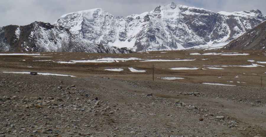
The pass is located on the ridgeline of the Himalayas, linking the Kamba County of Xigazê in the Tibet Autonomous Region of China with the Mangan District in North Sikkim, India. It is one of the most remote highest mountain roads of India. The summit is encircled by massive snow-covered peaks and offers views of the Khangchung Tso lake and the Teesta Khangtse Glacier, the source of the Teesta River.
Is the road to Khungyami La unpaved?
The road to the summit is totally unpaved, with loose scree and rocks. A heavy-duty 4x4 vehicle is required due to the unpredictable surface.
How long is the road to Khungyami La?
There are two routes to reach this extreme altitude, depending on which side of the border you start from:
- From China (Tibet): Starting from Jiruxiang (Yadong County), the road is 35.2 km long. Over this distance, you will overcome an elevation gain of 1,265m with a steady average gradient of 3.59%.
- From India (Sikkim): Starting from Thangu Valley (or Thangu-Chopta Valley), the journey is much more grueling. The road is 46.9 km long with a massive elevation gain of 1,957 meters.
Can I drive to Khungyami La?
While the road is technically drivable, access is strictly controlled. Because it sits directly on a sensitive international border, it requires special permits from the Army and the Sikkim police/administration on the Indian side, or equivalent military clearance on the Chinese side. These permits are not always granted to civilians or foreigners.
Is the road to Khungyami La open in winters?
Set high in the Dongkya Range of the Great Himalaya Range, accessibility is largely limited to the short summer season, as the pass is blocked by deep snow for most of the year. Due to the extreme elevation and exposure, you should expect brutal winds and rapid weather changes that can turn a clear day into a life-threatening blizzard in minutes.
Road suggested by: Hugh Wilson
Pic: Sushanta Banerjee