A dramatic road to the summit of Salsal La
Salsal La is a high mountain pass at an elevation of 5.201m (17,063ft) above the sea level, located in south-eastern Ladakh, in northern India’s Jammu and Kashmir state. It’s one of the highest roads of the country.
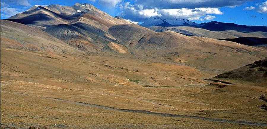
Tucked away in the Himalayan range, close to the Chumar area and the border with China, the road to the summit, also known as Salaal La, is mostly unpaved and impassable from October to June (weather permitting). The summers are warm but short and thunderstorms can occur at any time of year, often with hail. The winters are cold and Arctic-like. The drive is mostly flat, hitting a 6.7% of maximum gradient through some of the ramps.
Nestled in the midst of towering cliffs and peaks, in the Changtang, part of the high altitude Tibetan Plateau, the pass road is 79.4 km (49.33 miles) long, running north-south from Nyoma, the principal village of southern Ladakh and the headquarters of an eponymous subdivision towards Chumar, a village and a border patrol facility in south-eastern Ladakh. Very few tourists visit here since the route is tough and there are permit issues. 4wd vehicle required. There are high chances of getting affected by AMS (Altitude Mountain Sickness). The drive offers stunning views of the scenic Ryul Lake.
Road suggested by: jorge manuel gómez sánchez
Pic: rbhattoo