Quidijiankela pass, a military road to the summit
Quidijiankela pass is a high mountain pass at an elevation of 5.047m (16,558ft) above the sea level, located on the Line of Actual Control between China (Tibet Autonomous Region) and India (Jammu and Kashmir).
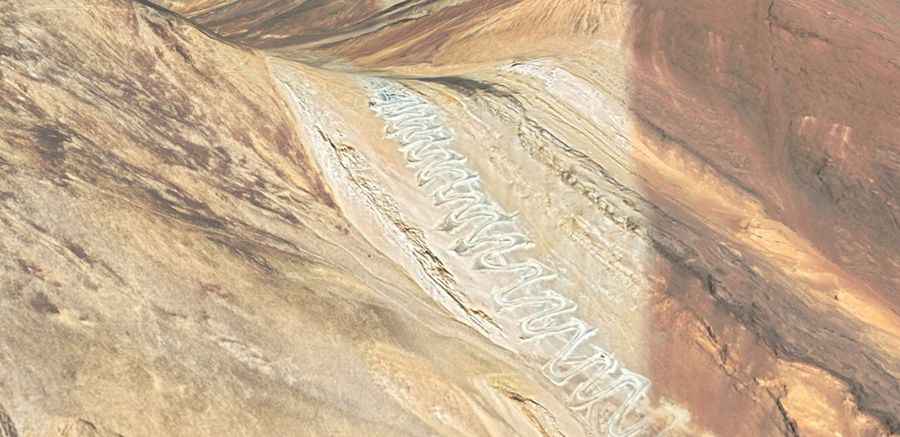
The winding and twisty road to the summit is unpaved. It’s a military road, totally closed to civilians. 4x4 vehicle required. The road is extremely steep, with more than 100 sharp hairpin turns. It runs from Spangur lake to Pangong lake.The summit is also known as Black Top or Kala Top (India) and Heiding, Shenpao Shan and Qiu Dijian (China).
West of the pass, at 33°37'22.3"N 78°46'24.8"E, a minor gravel road tops out at 5.676m (18,622ft) above the sea level. It’s one of the highest roads of the country. The summit hosts a military base, with a solar panel, generators, water tanks, bathrooms, etc.
Road suggested by: Jorge Manuel Gómez Sánchez