Driving the road to Lhari Peak: A 4.861m climb in the disputed Demchok sector
Lhari Peak is a high mountain peak reaching an elevation of 4,861 meters (15,948 ft) above sea level in the disputed Demchok sector of Ladakh, India. Located near the Line of Actual Control (LAC) with China, the unpaved military track branches off near Demchok and climbs to communications facilities and the Kailash OP Temple.
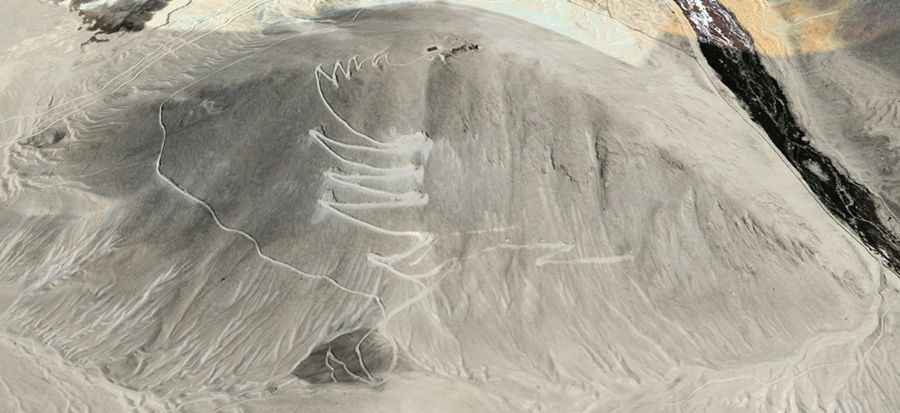
| Road facts: Lhari Peak | |
|---|---|
| Location | Demchok Sector, Ladakh (India) |
| Elevation | 4,861 m (15,948 ft) |
| Length | 7.4 km (4.6 miles) from Demchok |
| Elevation Gain | 602 vertical meters (1,975 ft) |
| Average Gradient | 8.13% |
| Hairpin Switchbacks | 16 turns |
| Surface | Unpaved glacial dust, loose scree, and rock |
| Access Restriction | Restricted military zone (Closed to foreign tourists) |
Where is the road to Lhari Peak located?
The road ascends the high-altitude desert terrain of the Nyoma tehsil in southeastern Ladakh. The track begins at the border settlement of Demchok and climbs 7.4 kilometers west up the mountain flanks to the 4,861-meter summit ridge.
Is the road to Lhari Peak paved?
No. The entire 7.4-kilometer track is completely unpaved, consisting of fine glacial dust, loose shale, and uncompacted rock. The route features 16 tight hairpin switchbacks carved into steep mountain slopes without protective guardrails.
What hazards exist when driving to Lhari Peak?
The primary physical hazards are extreme atmospheric oxygen loss at 4,861 meters that reduces engine power, steep 8.13% average gradients over loose rock ramps, and unshielded shelf-road drops. Heavy winter snowpack and ice block the 16 switchbacks for most of the year.
How long is the road to Lhari Peak?
Starting from Demchok, the climb measures 7.4 kilometers (4.6 miles) to the peak, gaining 602 vertical meters. Navigating the steep hairpins and loose surface requires continuous low-range 4x4 driving.