Is the road to Phatarian Gali suitable for RVs?
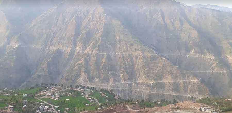
Phatarian Gali is a mountain pass at an elevation of 2,558 meters (8,392 ft) above sea level, located in the Jammu region of Jammu and Kashmir, India. The long mountain road crosses the ridge line to connect the localities of Ramban and Baddar.
| Road facts: Phatarian Gali | |
|---|---|
| Location | Jammu and Kashmir (India) |
| Elevation | 2,558 m (8,392 ft) |
| Length | 122 km (75 miles) |
| Average Gradient | 4.6% |
| Surface | Paved with narrow unpaved segments |
How long is the road through Phatarian Gali?
The regional road spans 122 kilometers (75 miles) from Ramban to Baddar, running through the steep valleys of the Jammu region. While the average gradient is a moderate 4.6%, the route consists of a continuous sequence of sharp hairpin turns and blind corners. The asphalted lane is very narrow in several sectors, lacking central markings or lateral safety guardrails above the unprotected steep drop-offs into the canyons.
What are the main hazards on the Phatarian Gali pass?
The single-lane mountain highway is highly subject to sudden rockfalls, heavy surface erosion, and major landslides triggered by monsoon rains, which often wash out parts of the asphalted trackbed. The route faces frequent high-altitude fog blankets that drop driving visibility to zero along the bends. Due to the narrowness of the lane and the sharp angles of the switchbacks, large vehicles or RVs face severe difficulties passing oncoming local mountain traffic and trucks.
Is the Phatarian Gali road open in winter?
Due to its altitude in northern India, the pass faces heavy alpine snow accumulation and remains completely blocked and impassable from late December until March. The route is not equipped with permanent snowplow services or clearing machinery during the winter freeze. During the summer months, the 122-kilometer transit lacks regional fuel stations or repair infrastructure along the main mountain ridge line.
Road suggested by: Jorge Manuel Gómez Sánchez
Pic: Sajad Ahmed