How to get to the summit of Natha Top in Jammu and Kashmir?
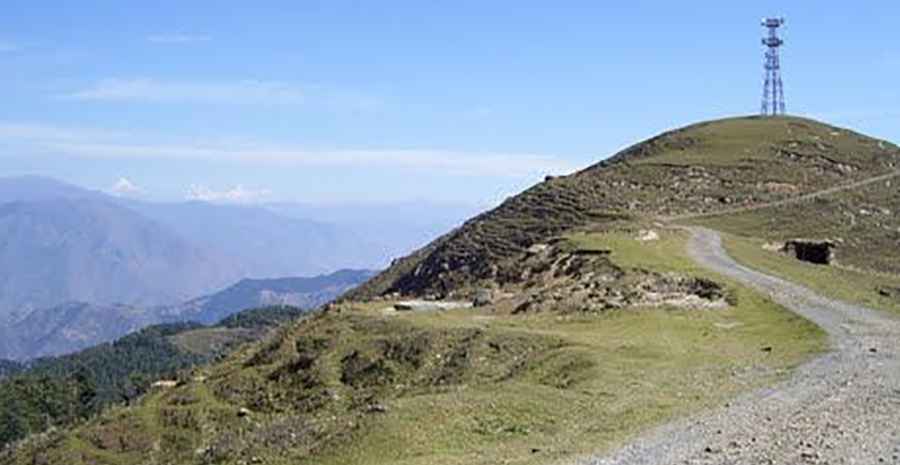
Natha Top is a high mountain peak at an elevation of 2,677m (8,782ft) above sea level, located in the Udhampur district of Jammu and Kashmir, India.
Is the road to Natha Top unpaved?
Located in the northern part of the country, the road to the summit is mostly unpaved and steep, with some narrow parts. The final climb is better with a 4x4 vehicle. It’s called Natha Top Road.
How long is the road to Natha Top?
Starting from Sanasar Road, the ascent is 5.6km (3.47 miles) long. Over this distance, the elevation gain is 193 meters. The average gradient is 3.44%.
What’s the weather like at Natha Top?
Given its elevation, there is snow here from December to February. The drive provides mesmerizing views of the Himalayas. The summit hosts a few communication facilities.
Road suggested by: Jorge Manuel Gómez Sánchez
Pic: http://mw2.google.com/mw-panoramio/photos/medium/48372647.jpg