If you love to drive, you’ll love the Patni Top road
Patnitop (or Patni Top) is a hilltop tourist location at an elevation of 2.048m (6,719ft) above sea level, located in Udhampur district in Jammu and Kashmir, in India.
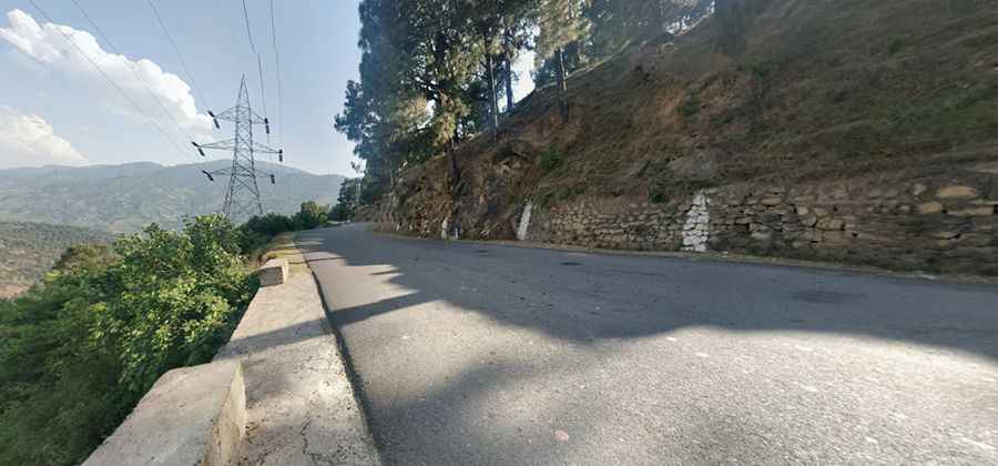
Is the road to Patni Top paved?
The road to the summit is paved. It’s called Jammu-Srinagar National Highway (part of National Highway 44). It’s a winding mountain road with excellent and clear view of the Himalayas.
How long is the road to Patni Top?
The road is 39.2 km long running south-north from Mantalai to Batote, a town in Ramban district.
Is the road to Patni Top open year-round?
Set high on the lower Himalayan range, the road is prone to snowfall and avalanches, causing long queues of vehicles - sometimes for days at length.
Is the road to Patni Top still in use?
Due to its challenging condition, the road was bypassed by the Dr. Syama Prasad Mookerjee Tunnel, the longest road of the country, with a length of 9.28 km (5.8 mi). It opened on 2 April 2017.
Pic: rohit sharma
Road suggested by: Jorge Manuel Gómez Sánchez