Travel guide to the top of Padri Pass
Padri Pass is a high mountain pass at an elevation of 3037m (9963ft) above sea level, located in India.
Where is Padri Pass?
The pass is located on the boundary between Jammu and Kashmir and Himachal Pradesh, in the northern part of the country. The area was a popular hideout for terrorists escaping from the Doda – Kishtwar area.
Is Padri Pass paved?
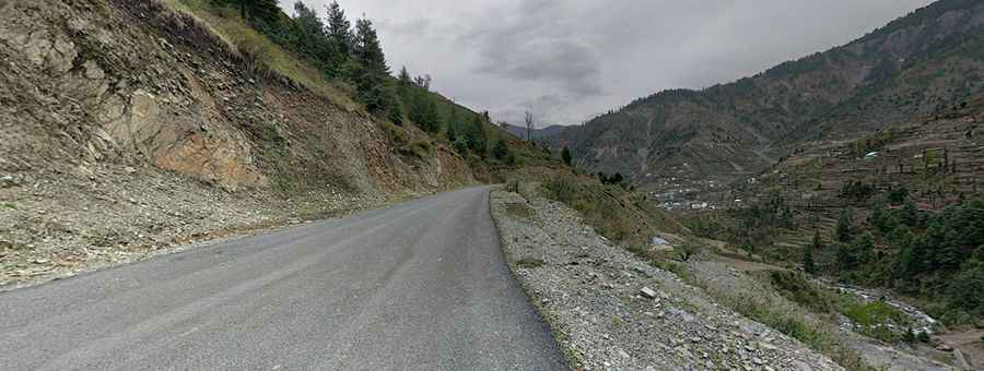
The road to the summit is mostly paved, with some short gravel sections along the way. It’s called Bhaderwah - Chamba Road.
Is Padri Pass open in winter?
Set high in the Himalayas mountain range, the road is usually closed due to snowfalls. Padri receives the heaviest snowfall in the area.
How challenging is Padri Pass?
The road is not easy, as it includes narrow sections and hundreds of turns. Pay attention to the condition of the road. You can see people from villages and animals by the road, so driving slowly is a good suggestion. Many drivers take this route to avoid the dangerous Saach Pass and Killar-Kishtwar Road on the way to North or the opposite side.
Is Padri Pass worth the drive?
Padri is famous as a picnic spot. The area is ideal for adventure sports like snow-skiing in winter and paragliding in summer. The surrounding landscape of forests and lush green meadows makes it a picturesque destination.
How long is Padri Pass?
The road was opened for outsiders in 2012-2013. The pass is 99.7 km (61.95 mile) long, running from the village of Bhadarwah to Surangani.
Road suggested by: Jorge Manuel Gómez Sánchez
Pic: Atique Mujawar