Dare to drive the steep road to Changi La
Changi La is a high mountain peak at an elevation of 4.235m (13,894ft) above sea level, located in the Indian administered union territory of Ladakh.
Where is Changi La?
The peak, also known as Randhawa Top, is located north of Kargil or Kargyil, in the disputed Kashmir region, near the Line of Control (LoC).
Why is it called Randhawa Top?
The peak is named after Major Baljit Singh Randhawa.
What’s at the summit of Changi La?
The summit hosts a few communication facilities and a war memorial known as Point 13620.
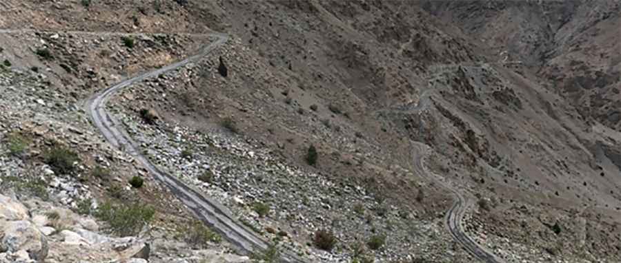
How steep is the road to Changi La?
The curvy road to the summit is very narrow and steep. It’s called Changi La Road. The road features 42 hairpin turns. Half of the road is well made, rest is a little off-road tarmac.
How long is the road to Changi La?
Starting from Akchamal, the road to the summit is 14.1 km long. Over this distance the elevation gain is 1.267 meters. The average gradient is 8.98%.
Road suggested by: Jorge Manuel Gómez Sánchez