Shashi La is a winding road for experienced drivers only
Shashi La is a high mountain pass at an elevation of 4.264m (1,3989ft) above sea level, located in the Ladakh Union territory in India.
Where is Shashi La?
The pass is located in the northern part of the country, within the Aryan valley.
Is the road to Shashi La unpaved?
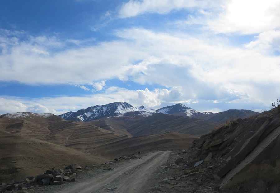
The road to the summit is totally unpaved and pretty steep (hitting a maximum gradient of 10% through some of the ramps), with some narrow parts. It’s called Shashila Road. 4x4 vehicles only.
How long is the road through Shashi La?
The pass is 35.1 km long, running east-west from Lalung to Hagnis.
How long does it take to drive the road through Shashi La?
Plan more than 3 hours to complete the journey due the road condition. The drive offers incredible views of the Pakistan border, the Nun Kun range in southwest, Karakoram ranges in north and Kashmir ranges in the west.
How steep is the road through Shashi La?
Starting from Lalung, the ascent is 9.5km long. Over this distance the elevation gain is 529 meters. The average gradient is 5.56%. And starting from Hagnis, the ascent is 25.6km long. Over this distance the elevation gain is 1.079 meters. The average gradient is 4.21%.
Road suggested by: Jorge Manuel Gómez Sánchez
Pic: Neeti Bassi