Dzang La: The Ultimate Road Trip Guide
Dzang La is a high mountain pass at an elevation of 5.287m (17,345ft) above the sea level, located in Gyirong county of Xigazê Prefecture, Tibet Autonomous Region, China.
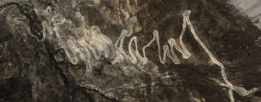
Set high in southwest China's Tibet Autonomous Region, the road to the summit, also known as Khojang La, is mostly paved with countless hairpin turns. The road follows the Ublung Chu valley and passes the peak of Kochang Kangri (6,022m). If you do choose this route please check up to date information.
The road to the summit is very steep, hitting a 13% of maximum gradient through some of the ramps. Starting at G216 road, the ascent is 22.5km (13.98 miles) long. Over this distance the elevation gain is 1448 meters. The average gradient is 6.43%.
Road suggested by: Hugh Wilson