How to drive the unpaved ridge track over Par La in Tibet?
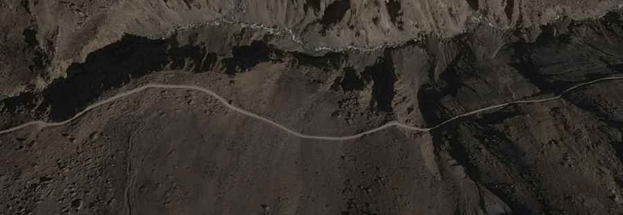
Par La is a high mountain pass at an elevation of 4,334 meters (14,219 ft) above sea level located in Kyirong County, Shigatse Prefecture, Tibet Autonomous Region, in China. Located near the Nepal border, the 17-kilometer unpaved ridge track connects Qiangla Longba with Gungtang (Kotang).
| Road facts: Par La Pass | |
|---|---|
| Location | Kyirong County, Shigatse, Tibet (China) |
| Coordinates | 28.802050, 84.799710 |
| Elevation | 4,334 m (14,219 ft) |
| Length | 17.0 km (10.56 miles) between Qiangla Longba and Gungtang |
| Surface | Unpaved dirt and loose gravel track |
| Vehicle Requirement | High-clearance 4WD required |
Where is Par La located?
The pass is situated in Kyirong County, southwestern Shigatse Prefecture, near the Nepalese border. The 17-kilometer route runs north-south at coordinates 28.802050, 84.799710, linking the settlements of Qiangla Longba and Gungtang (Gongdang).
Is the road over Par La paved?
No. The entire 17-kilometer stretch is completely unpaved, consisting of loose gravel, dirt, and stone. Unlike valley tracks, large sections of Par La follow exposed mountain ridges, forming a single-lane shelf road with zero guardrails or lateral safety buffers.
How long is the drive over Par La?
The unpaved ridge section covers 17.0 kilometers (10.56 miles). Negotiating the steep hairpin climb out of Qiangla Longba and the narrow ridge crests takes roughly 45 to 60 minutes of low-speed 4WD driving.
What hazards exist on Par La?
The main physical hazards are exposed cliff drop-offs on both sides of the ridge track, loose gravel slides triggered by rain, and thin atmospheric air at 4,334 meters that causes engine power loss. Heavy snow and ice block the pass during the winter months.
Road suggested by: Hugh Wilson