Kǒng Táng Lā: Driving the 32 hairpin turns of the abandoned 5,251m pass
Kǒng Táng Lā is a high mountain pass at an elevation of 5,251 meters (17,227 ft) above sea level, located in Nyalam County, within the Shigatse Prefecture of Tibet. The pass sits on the old road connecting Gyirong and Paiku Co lake.
| Road facts: Kǒng Táng Lā | |
|---|---|
| Location | Nyalam County, Tibet (China) |
| Elevation | 5,251 m (17,227 ft) |
| Length | 32.6 km (20.2 miles) |
| Hairpin Turns | 32 switchbacks |
| Surface | Paved (Cracked with loose debris) |
Is the road over Kǒng Táng Lā paved?
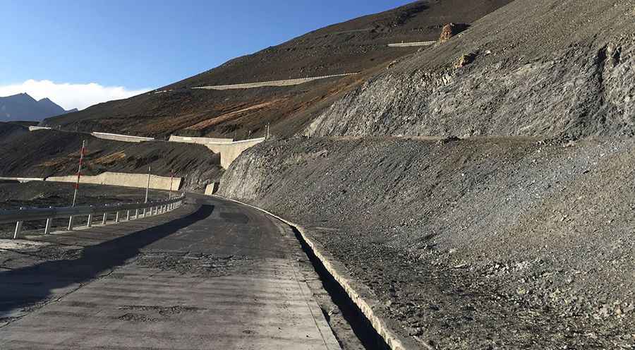
Yes, the original pass road is fully paved, but most through-traffic now uses a modern tunnel that bypasses the summit entirely. Because traffic has shifted to the tunnel, regular maintenance on the old surface is limited. The pavement shows cracks, frost damage, and fallen rock debris from the mountain slopes.
How long is the climb over Kǒng Táng Lā?
The old pass road spans 32.6 kilometers (20.2 miles), running south to north from Zhongma to Zharang. The main feature of the route is a continuous sequence of 32 sharp hairpin turns carved into the mountain face. At an elevation exceeding 5,200 meters, the severe lack of oxygen causes a major drop in engine power, forcing vehicles to climb slowly in lower gears.
What are the hazards on Kǒng Táng Lā?
The road features older concrete barriers and metal guardrails along the edge, but many sections remain unprotected above steep slopes. Black ice is common in shaded hairpins, even during the summer months. Heavy snowstorms can block the high pass, as snow clearance crews prioritize keeping the main tunnel open. There are no gas stations or services along this 32-kilometer mountain section.
Pic: p. pc高手