Driving the S202 Road: The 224km High-Altitude Corridor in Tibet
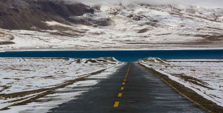
The S202 Road is a critical high-mountain highway located in the southeastern part of the Tibet Autonomous Region. Spanning 224 km (139 miles), this fully paved route serves as a north-south corridor between Shannan (Lhoka) and Cona, situated north of the Line of Actual Control near the India-Tibet border.
| Road facts: S202 (Tibet) | |
|---|---|
| Length | 224 km (139 miles) |
| Max Elevation | 5,119 m (16,794 ft) |
| Drive Time | 6 to 7 hours |
| Surface | Fully Paved |
Logistics of the S202 Highway
Driving the S202 requires a minimum of 6 to 7 hours without significant stops. The highway traverses the fertile Yarlung Valley and involves crossing two major high-altitude obstacles: the Yarto Drak La pass and the even higher Shobo La. While the road is paved and relatively straight in several sectors, it contains sustained steep ramps required to cross the massive Himalayan ridges. Fuel management is critical, as amenities are scarce between Shannan and Cona.
Weather Hazards and Operational Safety
Adverse weather conditions are a constant factor on the S202. Sudden blizzards and black ice can occur year-round due to the extreme elevation. Drivers must monitor oxygen levels and be prepared for rapid atmospheric changes. High-altitude maintenance is ongoing, but rockfalls and heavy snow accumulation can lead to temporary closures of this strategic corridor.