How to drive the mining road to Deyang La in Tibet?
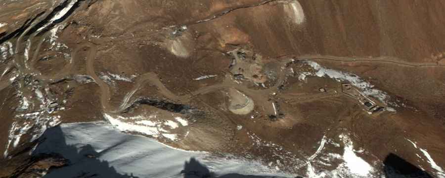
Deyang La is an extreme high-altitude mountain pass at an elevation of 5,381 meters (17,654 ft) above sea level, located in Maizhokunggar County, within the Lhasa prefecture of the Tibet Autonomous Region, China. The route to the summit is an unpaved industrial mine road built for heavy machinery extraction.
| Road facts: Deyang La Mine Road | |
|---|---|
| Location | Maizhokunggar, Lhasa, Tibet (China) |
| Elevation | 5,381 m (17,654 ft) |
| Length | 8.9 km (5.5 miles) from Tawuquie |
| Elevation Gain | 534 meters |
| Average Gradient | 6% |
| Surface | Unpaved (Sharp rock blocks and coarse gravel) |
Where does the Deyang La mine road start?
The unpaved mine road branches off near the locality of Tawuquie and runs for 8.9 kilometers (5.5 miles) to reach the upper structures of the mountain pass. The track covers an elevation gain of 534 vertical meters, maintaining a steady average gradient of 6%. The single lane is used continuously by heavy mining dump trucks and excavation machinery operating within the active industrial sectors of Maizhokunggar County.
What are the driving hazards on the Deyang La track?
The road surface consists of a raw, unmaintained trackbed littered with large, sharp granitic rock debris and loose uncompacted gravel. A high-clearance 4x4 vehicle with reinforced skid plates is required to prevent the protruding boulders from striking the differential housings or ripping the underbody components.
Is the road to Deyang La open in winter?
Due to its extreme altitude near Lhasa, the pass faces severe mountain freezing and is completely blocked by heavy snow drifts and thick ice from October until June, remaining entirely impassable. The track receives no civilian winter maintenance or snow clearing. During the summer opening, the single-lane road has no guardrails or lateral safety fences above the cliff sides, and the track profile changes constantly due to heavy machinery transit and sudden landslides caused by rainstorms.