Longga La
Longga La is a high mountain pass at an elevation of 5.159m (16,925ft) above the sea level, located in the Ngari Prefecture to the extreme south west of the Tibet Autonomous Region of China.
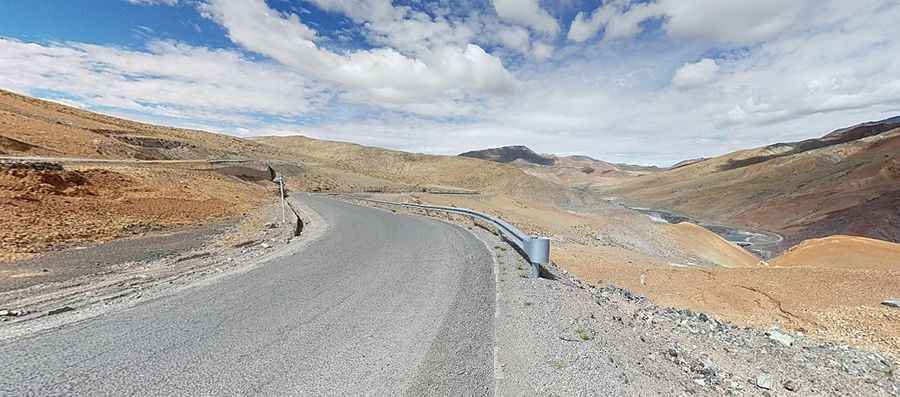
The road to the summit is asphalted. It’s called 705 County Road. Due to the high elevations and exposure, the road is subject to strong winds and rapid weather changes. Be prepared for the cold and wind! High winds blow here all year long. Even in summer you can confront with snowy days. Temperatures here in the winter are brutally cold. Adverse weather conditions can prompt closure of the road. It can often be treacherous, with ice and snow accumulating even in the summer, so exercise caution as you make your way. Do not take this drive if you have respiratory problems or any type of heart condition. Babies under 4 months of age should not make the ascent, either. Notorius lack of oxygen that tests the organisms and a high degree of steepness. The high elevation with its risk of altitude sickness, weather concerns, steep road grade, and overall inaccessibility make the travel dangerous and difficult. The road is pretty steep. Starting from 219 National Road, at 4.559m asl, the ascent is 13.1km long. Over this distance, the elevation gain is 600 meters. The average gradient is 4.58% with 16 hairpin turns.
Road suggested by: Hugh Wilson
Pic: Spikeehair