An Unforgettable Drive to Jamgang La
Jamgang La is a high mountain pass at an elevation of 5.257m (17,247ft) above the sea level, located in Nyalam County, in Tibet's Shigatse Prefecture.
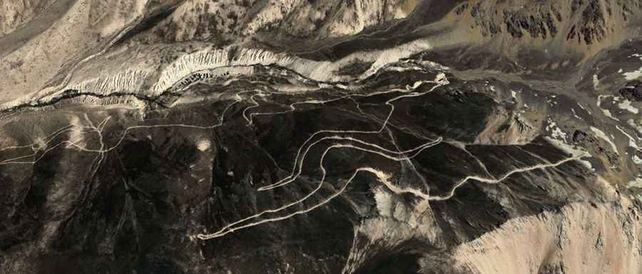
Set high in the Lapshi Gangri range, the road to the summit, also known as Simi La, Dehra Compass, Zullekang or just Kang La, is totally unpaved. A 4x4 vehicle is recommended. Always check the weather forecast before you start your journey: adverse conditions are common. When the snow falls - which it does in the winter – things get tough and slippery.
The road is 41.3 km (25.66 miles) long, running from G318 Road, near Naisha to Lapchi. The road to the summit is very steep, hitting a 15% of maximum gradient through some of the ramps. Nearby is Milarepa’s cave, a place of Buddhist pilgrimage and Phelgyeling monastery.
Road suggested by: Hugh Wilson