S206 Road: A 401km journey across the Tibetan Plateau's highest plains
The S206 Provincial Road is one of the most remote and highest paved highways in the world. Located in the Ngari Prefecture of central Tibet, this 401 km (249-mile) route serves as a strategic shortcut between the northern (S301) and southern (G219) regional roads. Fully paved in 2015, the S206 is a lonely journey through the "middle of nowhere," crossing vast uninhabited stretches of the Tibetan Plateau.
| Road facts: S206 Provincial Road | |
|---|---|
| Location | Ngari Prefecture, Tibet, China |
| Length | 401 km (249 miles) |
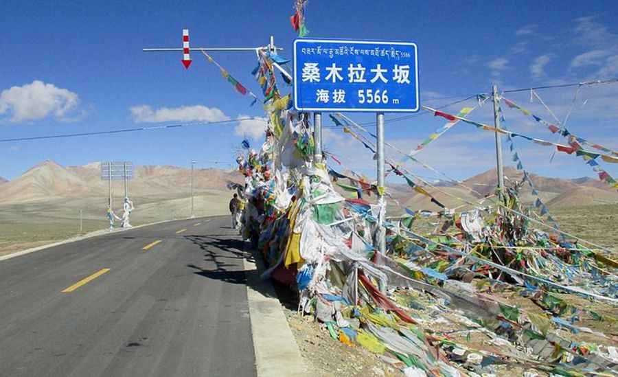
| Max Elevation | 5,578 m (18,300 ft) at Semo La |
| Surface | Paved (since 2015) |
How high does the S206 road go?
The S206 is extreme in its elevation profile. The road stays above 5,000 meters for more than 150 kilometers of its length. It tops out at 5,578m (18,300ft) at the Semo La pass. At these altitudes, oxygen levels are roughly 40% lower than at sea level, which puts extreme stress on both human respiratory systems and internal combustion engines. Many vehicles experience significant power loss, and drivers must be prepared for the symptoms of Acute Mountain Sickness (AMS).
What are the driving conditions like on S206?
The road crosses the Chang Tang region, a high-altitude wilderness known for its severe weather. Even in mid-summer, temperatures can drop from 20°C during the day to -10°C at night. July and August often bring heavy rains or sudden snowstorms. Strong winds are a constant factor, and patches of black ice can be found on the higher sections year-round. While the asphalt is relatively new, the isolation is total; you can drive for hours without seeing another vehicle.
Is the S206 road worth the drive?
For those prepared for the altitude, the S206 offers some of the most dramatic landscapes in Tibet. The route passes near the Nepal border and provides clear views of remote geysers, high-altitude lakes, and the glaciated peaks of the Himalayas. It is often used as a faster alternative to reach Mount Kailash when the more southern routes are affected by mud or landslides.
Pic: By V.Steuer (Own work) [CC BY-SA 4.0 (https://creativecommons.org/licenses/by-sa/4.0)], via Wikimedia Commons