How steep is the paved road to Zha La in Tibet?
Zha La is a high mountain pass at an elevation of 4,832 meters (15,853 ft) above sea level, located in Gyirong County within the Shigatse Prefecture of Tibet, China. The 15-kilometer mountain route connects Zhebaxiang with Kongtang, climbing through 12 sharp hairpin switchbacks across the Himalayan terrain.
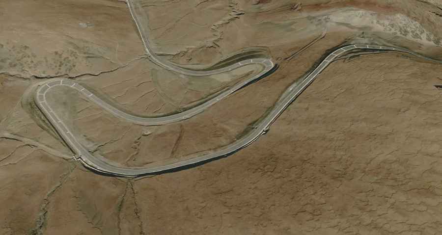
| Road facts: Zha La Pass | |
|---|---|
| Location | Gyirong County, Shigatse, Tibet (China) |
| Elevation | 4,832 m (15,853 ft) |
| Length | 15.0 km (9.3 miles) between Zhebaxiang and Kongtang |
| Hairpin Switchbacks | 12 turns |
| Surface | Paved asphalt |
| Key Hazards | 12 tight hairpins, steep vertical drop-offs, sudden black ice, altitude power loss |
Where is the Zha La pass located?
The pass is situated in Gyirong County in the southwestern part of Shigatse Prefecture, Tibet. The 15-kilometer road runs between the local settlements of Zhebaxiang and Kongtang, leading toward the Gyirong Valley near the Nepal border.
Is the road to Zha La paved?
Yes. The route was fully paved with asphalt, replacing the old dirt and gravel track. Despite the smooth pavement, the road remains narrow on the 12 hairpin bends, requiring long vehicles and trucks to use the entire width of the road to make the turns.
How long is the drive over Zha La?
The road stretches for 15.0 kilometers (9.3 miles). Driving through the continuous steep climb, tight switchbacks, and high elevation takes roughly 30 to 40 minutes of continuous low-gear driving.
What hazards exist on the Zha La pass?
The main physical hazards are the thin air at 4,832 meters that causes heavy engine power loss, unprotected drop-offs along the outer cliffs, and sudden black ice on shadowed bends. The steep downhill grade back toward the valley requires heavy engine braking to prevent brake overheating.