Is the S217 road to Zagashershar Pass in Sichuan paved?
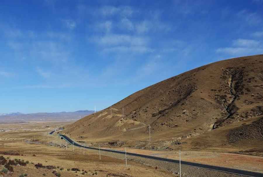
Reaching the Zagashershar Pass is a brutal climb into the Garzê Tibetan Autonomous Prefecture of Sichuan. At 4,130m (13,549ft) above sea level, this high mountain gap is a gateway to the remote wilderness of Western China. While the road has been recently paved, the smooth surface is a trap for the unwary; the combination of extreme altitude, vertical drops, and sudden visibility loss makes the S217 one of the most demanding drives in the region.
| Road facts: Zagashershar Pass (S217) | |
|---|---|
| Location | Litang County, Sichuan (China) |
| Elevation | 4,130m (13,549ft) |
| Road Name | S217 Provincial Road (Liya Highway) |
| Length | 19 km (11.8 miles) |
| Main Hazard | Altitude sickness / Heavy Mist / Blind Hairpins |
How long is the road to Zagashershar Pass?
The core section of the pass stretches for 19 km (11.8 miles), connecting the small settlements of Bengexiang and Jiawaxiang in Litang County. The S217, also known as the Liya Highway, is a long-distance lifeline that cuts through the mountains of the Tibetan plateau. Even with the new asphalt, the climb is grueling. Your engine will struggle as the oxygen thins out significantly above 4,000 meters. The road is a relentless series of switchbacks designed to gain elevation quickly, testing both your brakes on the way down and your cooling system on the way up.
What are the driving conditions on the Liya Highway?
The Liya Highway has seen major improvements, and the Zagashershar section is now fully paved. However, "paved" does not mean "safe" in this part of China. The asphalt can be deceptively slick, especially when the notorious heavy mist rolls in. Visibility often drops to less than ten meters, forcing you to crawl through the hairpins. Just as you reach the summit, you are greeted by a large rock covered in prayer flags and a Tibetan temple, a reminder of how high and isolated this route really is. Landslides are common during the rainy season, and rocks the size of a fist can litter the road after a storm.
Why is the Zagashershar Pass dangerous for drivers?
The real danger here is the altitude. At over 4,100 meters, altitude sickness can hit both the driver and the vehicle. You'll feel the lack of power in the accelerator, and your own reaction times might slow down. The road has no room for error; the steep embankments fall away into deep valleys with very little protection in several stretches. During winter or sudden cold snaps, the mist turns into black ice on the asphalt, making the descent a potential death trap. This is not a road for nighttime driving or for those without high-altitude experience.
What should you check before driving to Zagashershar?
Before you commit to this 19 km stretch of the S217, check your tires and your spare. You are in a very remote part of Litang, and help is hours—if not days—away. Ensure your vehicle’s fluids are topped up, as the steep grade will put massive pressure on the transmission. If the clouds are low or a storm is brewing, stay in Litang or the nearest village. The weather at 4,130 meters changes in minutes, and being caught in a blizzard on these hairpins is a situation you want to avoid at all costs.
Driving the Zagashershar Pass is an authentic Tibetan experience that demands respect for the height. It’s a road where the thin air and the heavy mist remind you who is really in charge. Keep your eyes on the asphalt, watch for falling rocks, and let the engine do the work on the descents. The Liya Highway is a journey of endurance, but the silence of the high plateau is worth every turn. Stay sharp.
Pic: sin Sin