Driving the 5,486m Samye La: A high-altitude challenge in Tibet
Samye La is a high mountain pass at a staggering elevation of 5,486 m (17,998 ft) above sea level, located in Zhongba County, within the Xigazê Prefecture of China's Tibet Autonomous Region. Standing near the 5,500m mark, it is one of the highest navigable points in the world.
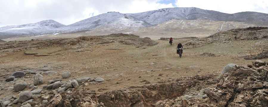
The pass is tucked away in the Gangdise range, a subrange of the Himalayas known for its spiritual significance and brutal topography. This is one of the most isolated regions on Earth, characterized by high-altitude deserts, crystalline alpine lakes, and a complete lack of human infrastructure. At nearly 5,500 meters, oxygen levels are about half of those at sea level, making it a high-risk environment for even the most experienced high-altitude travelers.
| Road facts: Samye La | |
|---|---|
| Location | Zhongba County, Tibet (China) |
| Elevation | 5,486 m (17,998 ft) |
| Road Name | 259 Country Road (West Tibet Highway) |
| Length | 88.9 km (55.24 miles) |
| Surface | Totally Unpaved / Dirt |
How is the road to Samye La?
The road over the summit is totally unpaved and consists of a raw dirt and gravel track known as the 259 Country Road (part of the West Tibet Highway network). Spanning 88.9 km (55.24 miles), the route runs south-north, connecting the iconic China National Highway 219 (G219) with the remote settlement of Buduoxiang. The track is extremely technical, requiring a high-clearance 4x4 vehicle and a self-sufficient mindset, as there is absolutely no traffic or roadside assistance in this part of the Transhimalaya.
When is Samye La open to traffic?
Due to its extreme altitude, the pass is impassable from September to June. For most of the year, the road is buried under heavy snow and ice. Even during the short summer window, travelers face severe challenges. During the monsoon season, particularly in late August and early September, the unpaved surface often suffers from deep mud and localized flooding from glacial melt. Samye La is also notorious for its relentless weather, being a place where you can experience strong, multi-directional winds simultaneously. Preparation is essential, as the route passes through a desolate landscape dotted with small, unnamed alpine lakes and high-altitude tundra.
Road suggested by: Hugh Wilson
Pic: Juntao JIANG