Dungda La in Tibet Is an Absolute Must for Road Lovers
Dungda La is a high mountain pass at an elevation of 5,090 m (16,699 ft) above sea level, located in Chamdo, in the eastern part of the Tibet Autonomous Region of China.
Is Dungda La paved?
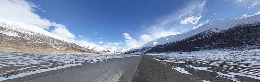
The road through the pass, also known as Dongda La and Dongdha La, is fully paved. It is called China National Highway 318, also known as the China-Nepal Highway and the Friendship Highway. The road is long and arduous and crosses several mountain passes through remote areas, so you need to be prepared.
How long is Dungda La?
The pass is 47.1 km (29.26 miles) long, running west-east from Luohong (Zogang County, Chamdo) to Zari Songduo (Markam County, Chamdo). The drive provides stunning mountain views.
How to drive to Dungda La?
Avoid this drive if you have respiratory issues or heart conditions. The route has a notorious lack of oxygen and very steep gradients, which can be physically demanding. Many travelers begin to experience altitude sickness around 2,500–2,800 meters, as oxygen levels drop significantly. The summit has roughly 40% less oxygen than at sea level, making breathing more difficult, increasing pulse rates, and making movement more strenuous. Engines also perform poorly due to the thin air. Altitude sickness can affect anyone, regardless of age or fitness. Combined with steep road grades, unpredictable weather, and limited accessibility, these factors make the pass dangerous and reaching the summit a challenging undertaking.
Pic: 陈冬阳