Mi La: The Ultimate Road Trip Guide
Mi La is a high mountain pass at an elevation of 5.010m (16,437ft) above the sea level, located in the Tibet Autonomous Region of China.
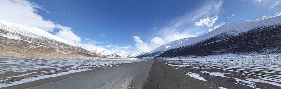
The road to the summit is called China National Highway 318, also known as China-Nepal Highway (Friendship Highway). The road is totally paved. Usually impassable from October to June. The summit offers a breathtaking scenery. The road is long and arduous and crosses several mountain passes through remote areas, so you need to be prepared. Do not take this drive if you have respiratory problems or any type of heart condition. Notorius lack of oxygen that tests the organisms and a high degree of steepness. Most people feel altitude sickness at around 2,500-2,800 meters. Extremely low oxygen for engine combustion. A major hazard of altitude is the sickness that can indiscriminately affect anyone regardless of age or fitness. The summit has about 40% less oxygen than at sea level, thus breathing is more difficult. Your pulse rate will increase and movement will be more laborious at the summit. The high elevation with its risk of altitude sickness, weather concerns, steep road grade, and overall inaccessibility make the pass dangerous and summit trips difficult. The zone is prone to heavy mist and can be dangerous in low visibility conditions. Do not travel this road in severe weather conditions. It’s a long but never steep climb. After the pass there’s an interesting change to more alpine scenery: rocky gorge and trees reappear. On 2019, the pass was bypassed by the Mi La Mountain tunnel, one of the highest vehicular tunnels in the world.
Pic: 陈冬阳