The Ultimate Road Trip To Suge La Pass in Tibet
Suge La is a high mountain pass at an elevation of 5,453m (17,890ft) above sea level, located in the Tibet Autonomous Region of the People's Republic of China.
Where is Suge La?
The pass is located on the boundary between Nyêmo and Damxung counties, at the western end of the Nyenchen Dangla Mountains.
Is Suge La unpaved?
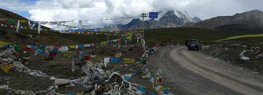
The road to the summit is completely unpaved but navigable by most passenger vehicles in dry weather. It’s called Provincial Road 304 (S304).
How long is Suge La?
The road through the summit is 170 km (105 mile) long running from the town of Yangbajain (on the China National Highway 109) to the 318 National Road (G318), the Tibet-Sichuan highway, near Dazhuka.
Is the road to Suge La challenging?
You will most likely be driving off-road, but the road surface is relatively good, so it is passable for almost any car (in good weather, of course). It is a wide dirt road that most vehicles can travel on. The bigger problem than the condition of the road is the extremely low oxygen for engine combustion. The ride is not easy, not suitable for a short road bike ride in the afternoon. The pass is not really steep compared to many others, but it does get close to 10% in some places.
Is the drive to Suge La worth it?
The pass itself is relatively flat and a little bit lost in the mountainsides, so it is worth going above it to have better views. The main attraction in the vicinity of the pass is the glacial peak of Qiongmo Kangri at 7,048m (23,123ft) above sea level, towering above everything.
Pic: https://www.gigaplaces.com/en/article-drive-across-the-suge-la-pass/