Road trip guide: Conquering Nathu La Pass in the Himalayas
Nathu La is an international high mountain pass at an elevation of 4.310m (14,140ft) above sea level, located at the Indo-China border.
Where is Nathu La located?
The pass connects Yadong County (on the Tibet region of China, part of its Shigatse Prefecture) and the mountainous northern Indian state of Sikkim. It is one of the three open trading border posts between China and India and is located 54 km (34 mi) east of Gangtok, the capital of Sikkim and 430 km (270 mi) from Lhasa, the capital of Tibet. Travelling to the area is difficult: a valid permit to visit the pass (a Protected Area Permit) is given to only Indian nationals. Photography is strictly prohibited. One can find ATM facility here which is the world’s highest Automated Teller Machine. On the Indian side, on the way to the pass, there's a famous lake, called Tsomgo Lake.
Can you drive to Nathu La?
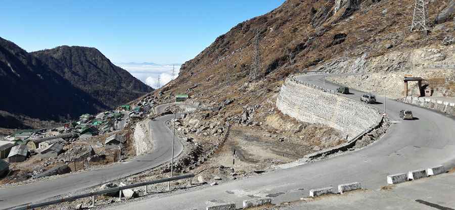
The road to the summit, also known as Nathula, Natu La or Natula, is totally paved. It’s a winding road through rugged mountain terrain and sharp cliffs, part of the ancient Silk Road, that takes you to the pass. Condition of the road usually remains bad due to snowy and foul weather conditions. At this elevation you might face breathing issues because of the thin air. Keep yourself hydrated and rest to avoid Altitude Mountain Sickness (AMS).
Is the road to Nathu La open?
Set high in the Dongkya Range of the Himalayas, on the Indo-Tibetan border, this road is seasonally impassable due to dangerous weather conditions. The pass experiences heavy snowfall during winter that restricts border trade to around 7 to 8 months. The temperature here remains low for most parts. During the months of May-June when it rains quite heavily landslides occur very frequently. The snow stops around the month of May. The border is open only from Wednesday to Sunday and it is guarded on both sides by Chinese and Indian soldiers.
Pic: debasish borgohain