An Unforgettable Drive to Gyatso La Pass on the Tibetan Plateau
At an elevation of 5,248m (17,217ft) above sea level, Gyatso La is the highest mountain pass along the legendary Friendship Highway (G318) in Tibet. Known as the gateway to the Everest region, it is a place where oxygen is scarce and the landscape is defined by its extreme desolation.
Where is Gyatso La?
The pass is located in Lhazê County of the Xigazê Prefecture, about 240 km west of Shigatse (Zhigatse) on the way to Nepal. Tucked away within the Qomolangma National Nature Reserve on the Tibetan Plateau, the surroundings of the pass are notoriously desolate: nothing grows here, it’s cold, empty, and frozen. Strategically, this point marks the official entry into the Everest National Park.
Breathtaking Views of Everest
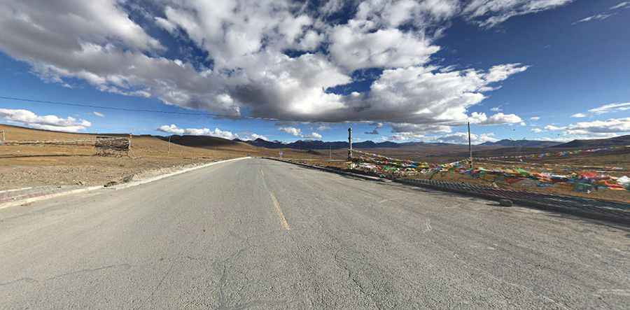
The summit of the pass hosts a massive collection of colorful prayer flags and monuments, but the real highlight is found a couple of kilometers beyond the crest. On a clear day, there are great views of Everest, appearing as a pointy snow-capped mountain in the distance, distinctly higher than those mountains around it. It is the first time on the journey from Lhasa that the world's highest peak reveals its full majesty.
Driving Conditions and Challenges at 5,000m+
Driving through Gyatso La (also known as Jia Tsuo La, Tsuo La, or Lhakpa La) is a test for any vehicle.
- The Road: This is the highest point on the asphalted 800-kilometer (500-mile) long Friendship Highway. While the road is newly paved, the extreme weather and seismic activity mean that it is frequently damaged and can be bumpy in sections.
- Atmospheric Pressure: At over 5,200 meters, the air pressure is significantly lower than at sea level. This leads to a substantial loss of engine power and requires drivers to be fully acclimatized to avoid High Altitude Sickness (AMS).
- Weather Hazards: The pass is exposed to relentless winds and can become impassable from October to June due to heavy snow and black ice.
Pic: Dale Gray