How to drive the cobblestone road to Fengxue Pass in Yunnan?
Fengxue Pass, also known as Fengxue Yakou, is a high mountain pass at an elevation of 3,157m (10,357ft) above sea level, located in Lushui County, Yunnan Province, in China.
| Road facts: Fengxue Pass (S327) | |
|---|---|
| Location | Lushui, Yunnan, China (near Myanmar border) |
| Elevation | 3,157 m (10,357 ft) |
| Length | 81.1 km (50.4 miles) |
| Surface | Cobblestone and broken pavement |
Is Fengxue Pass paved?
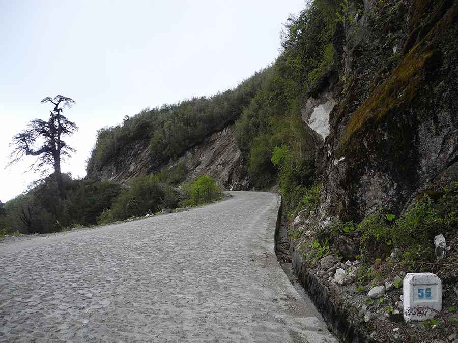
The road through the pass is called S327. It's known for its rough cobblestone surface, built decades ago. In the high-altitude sections, the stone blocks are constantly damp due to heavy mist and rain. Moss grows in the gaps between the cobblestones.
How long is the road to Fengxue Pass?
The road is 81km long, running between Pianmazhen and Luzhangzhen. Due to its location along the border with Myanmar, this mountain route is a major line for border patrol and local transport.
How challenging is the road to Fengxue Pass?
It features 300 sharp curves and hairpins. Most hairpins are blind, cut directly into the vertical dirt banks on one side and bordered by deep earthen drop-offs on the other
Is the drive to Fengxue Pass open in winter?
Set high in the rugged Gaoligong mountain range near the Myanmar border, the pass stays open most of the year, but ice from December to March makes the stone surface extremely slick. Freezing mist settles in the gaps between the cobblestones, forms a transparent layer of black ice. Due to the high-altitude, heavy snowfalls can temporarily block the summit.
Road suggested by: Hugh Wilson
Pic: 程亮