Driving the military roads to Tangkar La on the India-China border
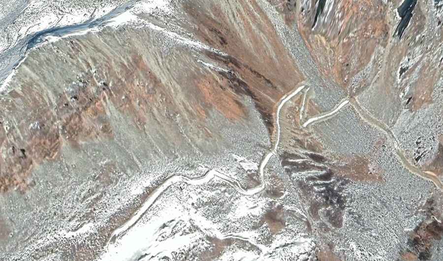
Tangkar La is an international high mountain pass located on the rugged border between India and China. The pass features two separate unpaved military access tracks that climb the mountain slopes from each country, meaning the roads do not connect or cross the international border at any point.
Where is Tangkar La?
The pass links the North Sikkim district of India with Yadong County in the Shigatse Prefecture of Tibet, China. Because the border is heavily militarized and disputed, there is no international crossing point or shared road infrastructure. The two distinct tracks serve exclusively as independent supply supply lines for the border outposts deployed on each side of the mountain.
How to get to Tangkar La in India?
On the Indian slope, the track climbs high into the Yumthang Valley. The surface of this route is completely unpaved, with loose mud, shale chunks, and raw mountain rocks. A low-range 4x4 vehicle with high clearance is strictly necessary to clear the deep ruts. The road tops out at an elevation of 4,439m (14,563ft) above sea level, where it reaches the local defense positions. It is a restricted military track operated by the Indian Army, completely closed to civilians and tourists.
How to get to Tangkar La in China?
On the Chinese side, the access road climbs from the base area of Suoguotang to a higher military checkpoint that tops out at 4,778m (15,675ft) above sea level. This dirt track is brutally steep, covering a 5km (3.1 miles) distance with an elevation gain of 762 meters, which translates to a punishing 15.24% average gradient. The most severe ramps hit a 35% maximum gradient. The route is controlled by the army, barred to civil traffic, and prone to rapid blockages due to high-altitude snow drifts.
Road suggested by: Hugh Wilson