How to drive the unpaved road to Drakde La in Qinghai?
Drakde La (also known as Dragde La) is a high-altitude mountain pass at an elevation of 4,611m (15,127ft) above sea level, located in Maqên County, within the Golog Tibetan Autonomous Prefecture of Qinghai, China.
| Road facts: Drakde La (Dragde La) | |
|---|---|
| Location | Golog Prefecture, Qinghai Province, China |
| Elevation | 4,611 m (15,127 ft) |
| Max Gradient | 9% |
| Surface | Unpaved (Gravel, Mud and Loose Rock) |
Is the road to Drakde La unpaved?
The road to the summit is totally unpaved. Heavy 4x4 vehicles equipped with all-terrain tires are required. The dirt trail is prone to severe alpine erosion and features a maximum gradient of 9%. Along the way you’ll encounter deep ruts, washouts, and large fallen stones blocking the lanes. There are no guardrails or safety barriers.
How dangerous is the road to Drakde La in winters?
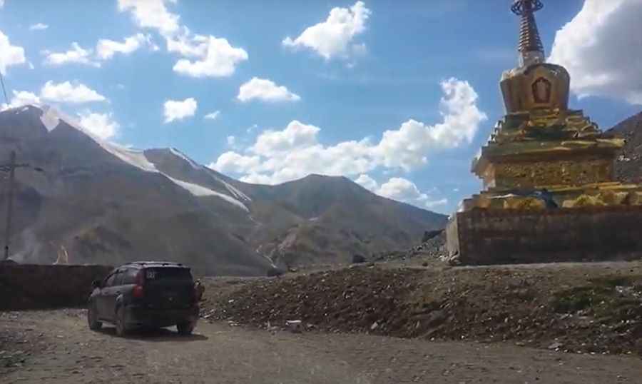
Set high in the Tibetan Plateau, the track runs close to the massive Mount Amnye Machen glaciers, exposing the driving surface to constant freezing. Mudslides and glacial meltwater streams regularly cut across the path, turning dry gravel into a thick, slippery fangar within minutes. Sudden summer snowstorms are common at this elevation. Near the summit, which is marked by a traditional stupa and prayer flags, the road narrows significantly and is exposed to violent mountain crosswinds.
Is the road to Drakde La still in use?
Due to the challenging condition of the road, it was bypassed by the modern G0615 Huajiu Highway via the Xueshan No.1 Tunnel. Long-distance trucks and heavy traffic now use the newer route.
Road suggested by: Hugh Wilson
Pic&video: Journey Beyond the Horizon