How to drive the unpaved road to Nangpa La?
Nangpa La is a high mountain pass at an elevation of 4,884m (16,023ft) above sea level, located in Baiyü County, in the western part of the Sichuan province, China.
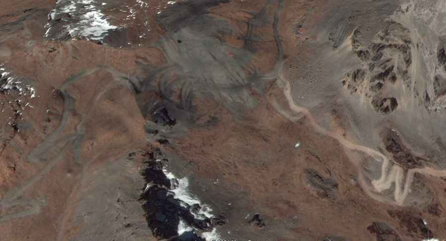
| Road facts: Nangpa La | |
|---|---|
| Elevation | 4,884m (16,023ft) |
| Location | Baiyü County, Sichuan (China) |
| Length | 23.9 km (14.85 miles) |
| Max Gradient | 31% |
| Average Gradient | 7.80% |
Where is Nangpa La?
The pass is located in the south-central part of the country, near the border with the Tibet Autonomous Region. Due to its location in a far-western corner of Sichuan, the area remains extremely isolated. Travelers should be fully self-sufficient, as modern facilities such as medical aid, electricity, or running water are not available along this mountain track.
Is Nangpa La unpaved?
The road to the summit is totally unpaved and demands a high-clearance 4x4 vehicle. The track is characterized by dozens of sharp bends and a surface of loose gravel and dirt.
How long is the road to Nangpa La?
Starting north of Shamaxiang, the road to the summit is 23.9 km long. Over this distance, the average gradient is 7.80%. The real challenge lies in the specific ramps where the maximum gradient hits 31%.
Is the road to Nangpa La open year-round?
Because of its high altitude and border location, the road is prone to rapid weather changes. Snow can block the pass even outside the winter months. Before attempting this route, it is vital to secure local information regarding the road's status and any travel permits required for this sensitive border area between Sichuan and Tibet.
Road suggested by: Hugh Wilson