How to drive the unpaved road to Bod La and Gong La?
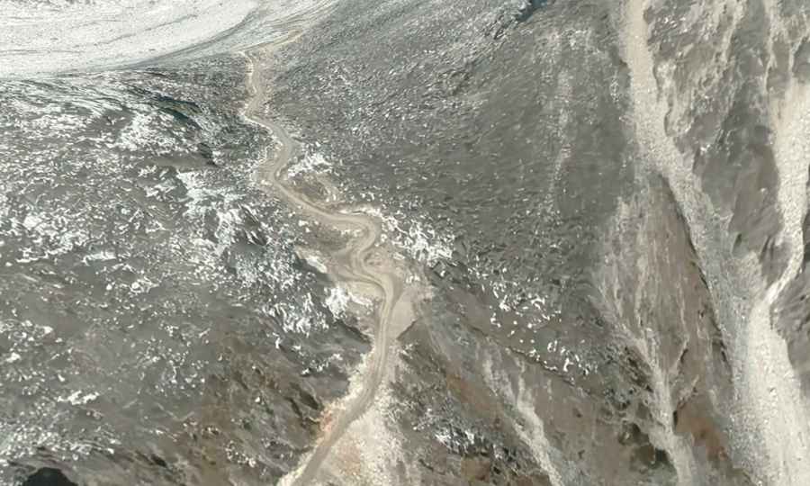
The road from Lakangzhen to Gong La is a high mountain track located in Lhozhag County, within the Shannan Prefecture of Tibet. Starting from the G219 highway, this 58.8 km unpaved route is a mining track that crosses two high-altitude passes near the Bhutanese border.
Is the road from Lakangzhen to Gong La unpaved?
The road is totally unpaved. It’s mainly used for mining trucks.
How long is the road from Lakangzhen to Gong La?
The 58.8 km climb features 102 sharp switchbacks carved into the mountain face. These turns are narrow, steep, and lack any form of guardrails or safety barriers. Driving this sector requires a high-clearance 4x4 vehicle. You must be prepared to encounter heavy mining trucks on the narrowest shelf sections, where reversing on a steep gradient is often the only way to allow them to pass.
What’s the highest elevation of the road?
The 58.8 km drive reaches its highest point at Bod La (4,991m) before ending at Gong La (4,800m). At nearly 5,000 meters, the lack of oxygen causes a significant drop in engine power.
Is the Gong La road passable throughout the year?
The track is impassable from late October through late June due to heavy snowfall blocking the Bod La and Gong La passes. Even in summer, sudden storms can turn the unmaintained dirt surface into deep mud, making traction impossible. Landslides are a constant risk in this border area, especially after rain.
How remote is the road to Gong La?
The track leads through an isolated high-altitude desert where no facilities, fuel, or workshops exist for the entire duration of the drive. Being a sensitive border area, ensure you have the required Tibet Travel Permits before attempting the transit.
Road suggested by: Hugh Wilson