How to drive the paved Baojin Line to Xuechao Pass
Xuechao Pass is a high mountain pass at an elevation of 3,707m (12,162ft) above sea level, located in China.
Where is Xuechao Pass?
The pass is located on the border between Xiaojin County and Kangding in Sichuan.
Is the Baojin Line to Xuechao Pass paved?
The road to the summit is part of the Baojin Line. The 133 km route starts paved from Baoxing County through Longdong Town, but the asphalt ends after Zhonggang Village. From this point, the road becomes an unpaved track with deep ruts and loose gravel. The surface is prone to erosion from snow-capped peak runoff, which creates deep gullies across the path.
Can I drive my vehicle to Xuechao Pass?
A high-clearance 4x4 is required to complete the drive, due to the steep, uncompacted ramps that lead to the summit.
What are the risks on the road to Xuechao Pass?
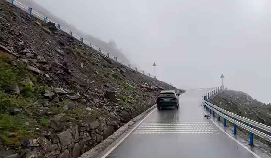
Rockslides are common on the Baojin Line, as the track is cut into unstable mountain faces where rain triggers immediate debris flows. At the summit high-altitude fog frequently reduces visibility to less than five meters, making the sharp bends and vertical drops extremely hazardous.
How remote is the road to Xuechao Pass?
Between Zhonggang Village and Meiwo Township, there is zero mobile signal for dozens of kilometers; any mechanical failure or tire puncture means you are isolated without any possibility of calling for help. You must use pre-set GPS navigation, as the track has multiple forks with no signage and no digital map updates. Carry a full-sized spare tire and extra fuel, as consumption increases on the unpaved mountain ramps. Ensure you have emergency supplies and a satellite communication device, as the lack of signal in the high-altitude wilderness makes any breakdown a critical situation.
Road suggested by: Hugh Wilson
Pic&video: 中国街景 China Street View