How to drive the 100 hairpin turns to Chuti Chang La?
Chuti Chang La is a high mountain pass at an elevation of 5,047m (16,558ft) above sea level, located on the Line of Actual Control (LAC) between Tibet and Ladakh.
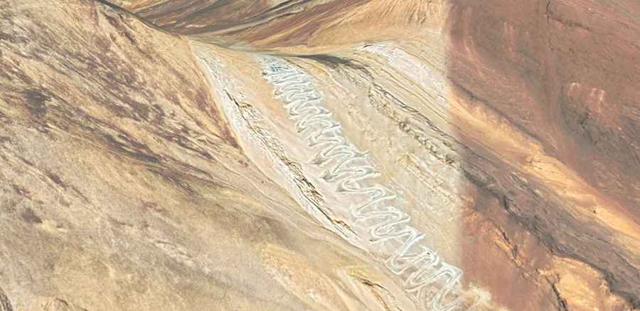
How long is the road to Chuti Chang La?
The road through the pass is totally unpaved. It’s 29 km (18 miles) long and runs from Pangong Tso to Spanggur Tso.
Is the road to Chuti Chang La unpaved?
The military track to the summit features over 100 switchbacks to climb the steep granite slopes. The turns are extremely tight, often requiring a short-wheelbase 4x4 to avoid multi-point maneuvers on the edge of the precipice. The surface is loose scree where tires spin easily; if you stop on a steep ramp, the lack of traction makes restarting the climb difficult.
How demanding is the road to Chuti Chang La?
At 5,047 meters, the air density is 50% lower than at sea level, causing a massive loss of engine torque. The road is a military zone with no safety barriers; armored units have absolute priority, often forcing you to stop on narrow shelf sections to let them pass.
Is the road to Chuti Chang La open year-round?
At this elevation, the road to the pass, also known as Quidijiankela Pass, is totally impassable in winters.
Road suggested by: Jorge Manuel Gómez Sánchez