Driving the military road to the international Kasa Irunun Beli Pass
Kasa Irunun Beli Pass is a high mountain pass at an elevation of 4,691 meters (15,390 ft) above sea level, located on the restricted border between Tajikistan and China. The extreme altitude and the sensitive border location make it one of the most restricted drives in Central Asia.
Where is Kasa Irunun Beli Pass located?
The pass is located on the boundary between the Gorno-Badakhshan Autonomous Region of Tajikistan and Akto County, in Kizilsu Kyrgyz Autonomous Prefecture, Xinjiang Uygur Autonomous Region of China. This is a highly sensitive military zone, and anyone attempting to drive here needs special permits from the Chinese authorities, as the road is primarily used for border patrols and military logistics.
Why is there a road to the summit of Kasa Irunun?
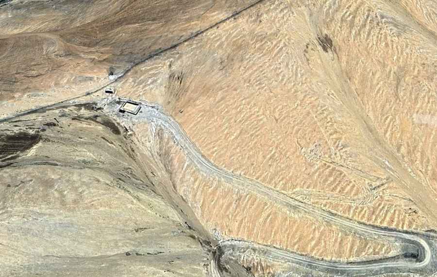
The road was built specifically for military purposes to maintain a presence on the high-altitude border with Tajikistan. At the summit, there are military outposts and border markers. Along the way you’ll encounter military checkpoints where your documentation must be perfect.
How long is the road to Kasa Irunun?
Set high in the eastern Pamir Mountains, the road to the summit is a 27.8-kilometer drive starting from Alashidun. A heavy-duty 4x4 is strictly required. The surface is entirely unpaved, consisting of loose gravel, fine Pamir dust, and sharp rocky rubble. There’s not road to the summit if driving from Tajikistan.
How remote is the road to Kasa Irunun?
Isolation here is absolute. There are no services, no fuel stations, and no workshops for hundreds of kilometers. The environment is a high-altitude desert with no vegetation and very little water.
Road suggested by: Hugh Wilson