How to drive the Unpaved Road to Zing La in Cona County
Zing La is a high mountain pass at an elevation of 4,936m (16,194ft) above sea level, located in Cona County, within the Shannan Prefecture of Tibet. The rugged, unpaved track to the summit connects the high valleys of the region.
Where is Zing La located?
The pass is located in Cona County, part of the Shannan prefecture in southern Tibet, in one of the highest and most remote regions of the Himalayas, very close to the border with India.
Is the road to Zing La unpaved?
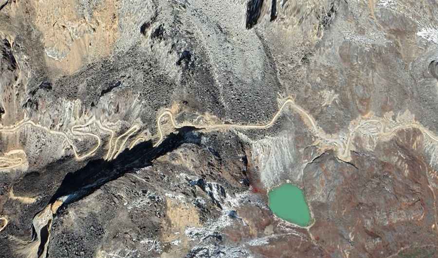
The road to the summit is totally unpaved and consists of loose gravel, dirt, and rocky sections. The track is famous for its dozens of sharp hairpin turns, especially near the summit. The surface is often uneven, with deep ruts that can damage the car. A high-clearance 4x4 vehicle is strictly required to drive the steep ramps and the unstable ground.
How long is the road to Zing La?
The road to the summit is 39 km (24.2 miles) long, starting from Cona. You must carry at least one full-size spare tire, as the sharp Himalayan rocks are known for cutting through sidewalls, and there are no repair shops along the entire route.
Is the road to Zing La open in winter?
Situated deep in the Himalaya range near the border, the pass is blocked by heavy snow and ice for most of the year. Even in late spring or early autumn, sudden blizzards can make the track impassable in minutes. During the summer, melting snow can turn the dirt sections into thick mud traps. There are no safety barriers on the hairpins, so one wrong move on a soft shoulder or a slide on the ice can be fatal.